You are here: Home > Network List > IU - Global Seismograph Network (GSN - IRIS/USGS) Stations List
> Station RSSD Black Hills, South Dakota, USA > Earthquake Result Viewer
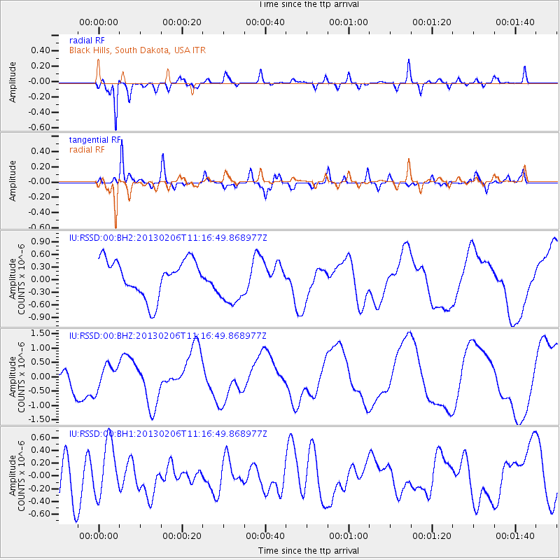
RSSD Black Hills, South Dakota, USA - Earthquake Result Viewer
*The percent match for this event was below the threshold and hence no stack was calculated.
| Earthquake location: |
Santa Cruz Islands |
| Earthquake latitude/longitude: |
-10.7/165.2 |
| Earthquake time(UTC): |
2013/02/06 (037) 11:03:45 GMT |
| Earthquake Depth: |
10 km |
| Earthquake Magnitude: |
5.6 MB, 5.6 MS, 5.8 MW |
| Earthquake Catalog/Contributor: |
WHDF/NEIC |
|
| Network: |
IU Global Seismograph Network (GSN - IRIS/USGS) |
| Station: |
RSSD Black Hills, South Dakota, USA |
| Lat/Lon: |
44.12 N/104.04 W |
| Elevation: |
2090 m |
|
| Distance: |
97.9 deg |
| Az: |
46.642 deg |
| Baz: |
262.822 deg |
| Ray Param: |
$rayparam |
*The percent match for this event was below the threshold and hence was not used in the summary stack. |
|
| Radial Match: |
86.97611 % |
| Radial Bump: |
400 |
| Transverse Match: |
79.974014 % |
| Transverse Bump: |
400 |
| SOD ConfigId: |
558545 |
| Insert Time: |
2013-09-18 05:52:32.024 +0000 |
| GWidth: |
2.5 |
| Max Bumps: |
400 |
| Tol: |
0.001 |
|
Signal To Noise
| Channel | StoN | STA | LTA |
| IU:RSSD:00:BHZ:20130206T11:16:49.868977Z | 0.7503449 | 4.0241105E-7 | 5.3630146E-7 |
| IU:RSSD:00:BH1:20130206T11:16:49.868977Z | 1.7305223 | 4.4084246E-7 | 2.5474532E-7 |
| IU:RSSD:00:BH2:20130206T11:16:49.868977Z | 1.3488032 | 5.760801E-7 | 4.2710462E-7 |
| Arrivals |
| Ps | |
| PpPs | |
| PsPs/PpSs | |


