You are here: Home > Network List > US - United States National Seismic Network Stations List
> Station HLID Hailey, Idaho, USA > Earthquake Result Viewer
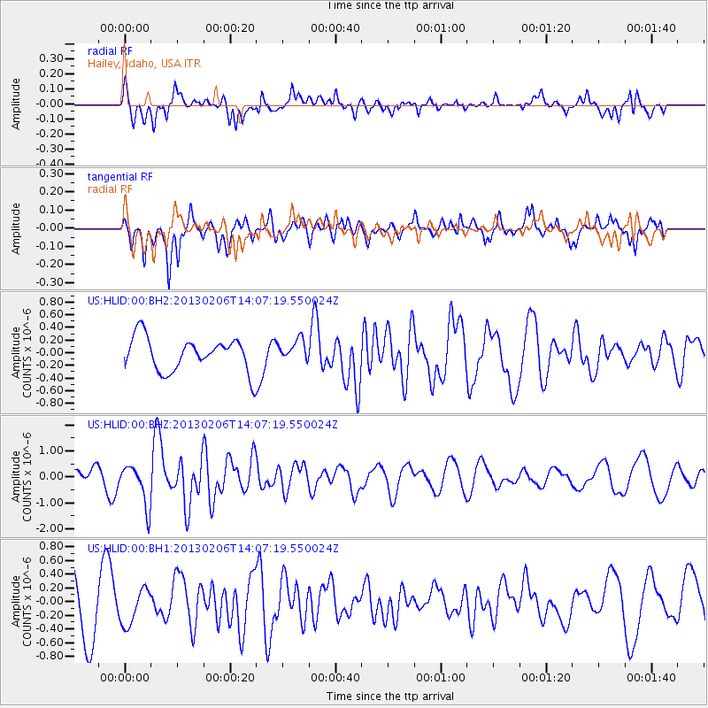
HLID Hailey, Idaho, USA - Earthquake Result Viewer
*The percent match for this event was below the threshold and hence no stack was calculated.
| Earthquake location: |
Santa Cruz Islands |
| Earthquake latitude/longitude: |
-10.8/166.5 |
| Earthquake time(UTC): |
2013/02/06 (037) 13:54:54 GMT |
| Earthquake Depth: |
14 km |
| Earthquake Magnitude: |
6.0 MB, 5.7 MS, 5.8 MW, 5.8 MW |
| Earthquake Catalog/Contributor: |
WHDF/NEIC |
|
| Network: |
US United States National Seismic Network |
| Station: |
HLID Hailey, Idaho, USA |
| Lat/Lon: |
43.56 N/114.41 W |
| Elevation: |
1772 m |
|
| Distance: |
89.6 deg |
| Az: |
45.54 deg |
| Baz: |
254.723 deg |
| Ray Param: |
$rayparam |
*The percent match for this event was below the threshold and hence was not used in the summary stack. |
|
| Radial Match: |
65.905464 % |
| Radial Bump: |
400 |
| Transverse Match: |
58.65945 % |
| Transverse Bump: |
372 |
| SOD ConfigId: |
558545 |
| Insert Time: |
2013-09-18 06:01:28.169 +0000 |
| GWidth: |
2.5 |
| Max Bumps: |
400 |
| Tol: |
0.001 |
|
Signal To Noise
| Channel | StoN | STA | LTA |
| US:HLID:00:BHZ:20130206T14:07:19.550024Z | 2.9504716 | 8.0324986E-7 | 2.7224456E-7 |
| US:HLID:00:BH1:20130206T14:07:19.550024Z | 0.58504367 | 2.5956965E-7 | 4.4367567E-7 |
| US:HLID:00:BH2:20130206T14:07:19.550024Z | 0.6438421 | 1.6918518E-7 | 2.6277434E-7 |
| Arrivals |
| Ps | |
| PpPs | |
| PsPs/PpSs | |


