
DRLN Deer Lake, NFLD. - Earthquake Result Viewer
| ||||||||||||||||||
| ||||||||||||||||||
| ||||||||||||||||||
|
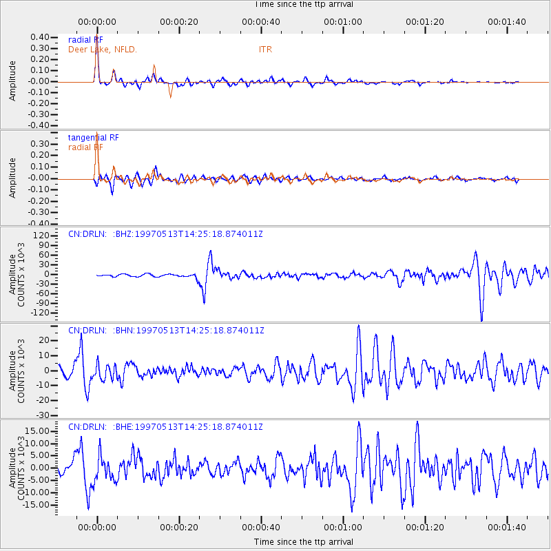
Signal To Noise
| Channel | StoN | STA | LTA |
| CN:DRLN: :BHN:19970513T14:25:18.874011Z | 1.9935851 | 4831.4585 | 2423.5024 |
| CN:DRLN: :BHE:19970513T14:25:18.874011Z | 2.3383925 | 5023.714 | 2148.362 |
| CN:DRLN: :BHZ:19970513T14:25:18.874011Z | 2.2578695 | 10870.374 | 4814.439 |
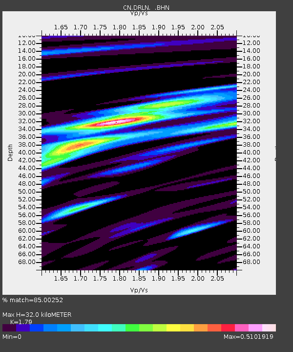
| Arrivals | |
| Ps | 4.1 SECOND |
| PpPs | 14 SECOND |
| PsPs/PpSs | 18 SECOND |

