You are here: Home > Network List > US - United States National Seismic Network Stations List
> Station WUAZ Wupatki, Arizona, USA > Earthquake Result Viewer
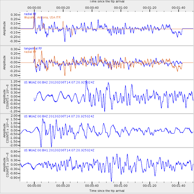
WUAZ Wupatki, Arizona, USA - Earthquake Result Viewer
*The percent match for this event was below the threshold and hence no stack was calculated.
| Earthquake location: |
Santa Cruz Islands |
| Earthquake latitude/longitude: |
-10.8/166.5 |
| Earthquake time(UTC): |
2013/02/06 (037) 13:54:54 GMT |
| Earthquake Depth: |
14 km |
| Earthquake Magnitude: |
6.0 MB, 5.7 MS, 5.8 MW, 5.8 MW |
| Earthquake Catalog/Contributor: |
WHDF/NEIC |
|
| Network: |
US United States National Seismic Network |
| Station: |
WUAZ Wupatki, Arizona, USA |
| Lat/Lon: |
35.52 N/111.37 W |
| Elevation: |
1592 m |
|
| Distance: |
89.9 deg |
| Az: |
53.905 deg |
| Baz: |
256.698 deg |
| Ray Param: |
$rayparam |
*The percent match for this event was below the threshold and hence was not used in the summary stack. |
|
| Radial Match: |
69.1743 % |
| Radial Bump: |
400 |
| Transverse Match: |
66.836464 % |
| Transverse Bump: |
400 |
| SOD ConfigId: |
558545 |
| Insert Time: |
2013-09-18 06:01:51.531 +0000 |
| GWidth: |
2.5 |
| Max Bumps: |
400 |
| Tol: |
0.001 |
|
Signal To Noise
| Channel | StoN | STA | LTA |
| US:WUAZ:00:BHZ:20130206T14:07:20.925024Z | 3.5359392 | 7.038283E-7 | 1.9904988E-7 |
| US:WUAZ:00:BH1:20130206T14:07:20.925024Z | 0.82530606 | 1.4197613E-7 | 1.7202846E-7 |
| US:WUAZ:00:BH2:20130206T14:07:20.925024Z | 1.38561 | 3.0934527E-7 | 2.2325565E-7 |
| Arrivals |
| Ps | |
| PpPs | |
| PsPs/PpSs | |


