DRLN Deer Lake, NFLD. - Earthquake Result Viewer
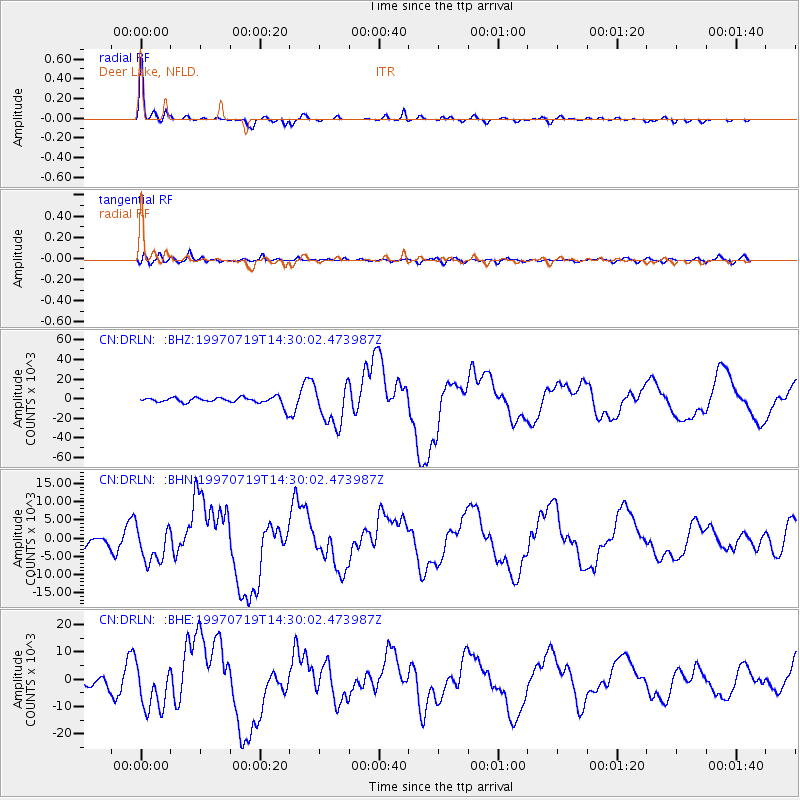
Earthquake location: Near Coast Of Guerrero, Mexico
Earthquake latitude/longitude: 16.3/-98.2
Earthquake time(UTC): 1997/07/19 (200) 14:22:08 GMT
Earthquake Depth: 33 km
Earthquake Magnitude: 5.7 MB, 6.3 MS, 6.8 UNKNOWN, 6.0 ME
Earthquake Catalog/Contributor: WHDF/NEIC
Network: CN Canadian National Seismograph Network
Station: DRLN Deer Lake, NFLD.
Lat/Lon: 49.26 N/57.50 W
Elevation: 238 m
Distance: 46.5 deg
Az: 36.077 deg
Baz: 239.649 deg
Ray Param: 0.07052492
Estimated Moho Depth: 35.75 km
Estimated Crust Vp/Vs: 1.74
Assumed Crust Vp: 6.35 km/s
Estimated Crust Vs: 3.66 km/s
Estimated Crust Poisson's Ratio: 0.25
Radial Match: 93.44888 %
Radial Bump: 256
Transverse Match: 77.42988 %
Transverse Bump: 400
SOD ConfigId: 6273
Insert Time: 2010-02-27 05:35:51.141 +0000
GWidth: 2.5
Max Bumps: 400
Tol: 0.001

Signal To Noise

ChannelStoNSTALTA
CN:DRLN: :BHN:19970719T14:30:02.473987Z2.9924024930.62261647.7139
CN:DRLN: :BHE:19970719T14:30:02.473987Z5.59745178205.3481465.9077
CN:DRLN: :BHZ:19970719T14:30:02.473987Z5.57304620818.2833735.53
Arrivals
Ps4.4 SECOND
PpPs14 SECOND
PsPs/PpSs19 SECOND