You are here: Home > Network List > US - United States National Seismic Network Stations List
> Station MNTX Cornudas Mountains, Texas, USA > Earthquake Result Viewer
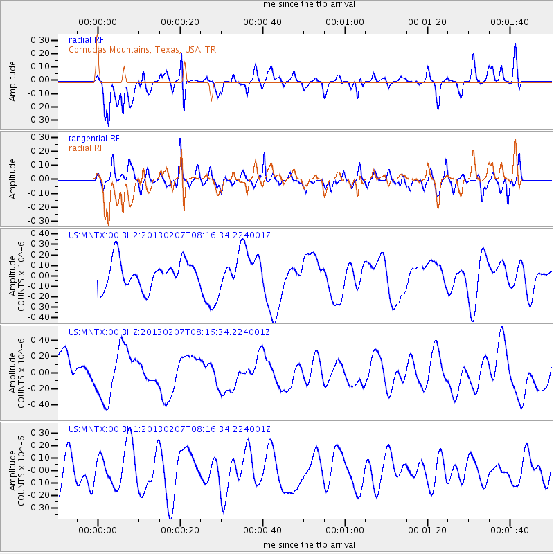
MNTX Cornudas Mountains, Texas, USA - Earthquake Result Viewer
*The percent match for this event was below the threshold and hence no stack was calculated.
| Earthquake location: |
Santa Cruz Islands Region |
| Earthquake latitude/longitude: |
-11.0/164.8 |
| Earthquake time(UTC): |
2013/02/07 (038) 08:03:40 GMT |
| Earthquake Depth: |
11 km |
| Earthquake Magnitude: |
5.5 MB, 5.4 MS, 5.8 MW, 5.8 MW |
| Earthquake Catalog/Contributor: |
WHDF/NEIC |
|
| Network: |
US United States National Seismic Network |
| Station: |
MNTX Cornudas Mountains, Texas, USA |
| Lat/Lon: |
31.70 N/105.38 W |
| Elevation: |
404 m |
|
| Distance: |
95.6 deg |
| Az: |
58.919 deg |
| Baz: |
260.547 deg |
| Ray Param: |
$rayparam |
*The percent match for this event was below the threshold and hence was not used in the summary stack. |
|
| Radial Match: |
69.08227 % |
| Radial Bump: |
400 |
| Transverse Match: |
65.17312 % |
| Transverse Bump: |
400 |
| SOD ConfigId: |
558545 |
| Insert Time: |
2013-09-18 06:15:04.267 +0000 |
| GWidth: |
2.5 |
| Max Bumps: |
400 |
| Tol: |
0.001 |
|
Signal To Noise
| Channel | StoN | STA | LTA |
| US:MNTX:00:BHZ:20130207T08:16:34.224001Z | 1.4160966 | 2.933831E-7 | 2.0717731E-7 |
| US:MNTX:00:BH1:20130207T08:16:34.224001Z | 0.98350847 | 1.0481774E-7 | 1.0657533E-7 |
| US:MNTX:00:BH2:20130207T08:16:34.224001Z | 1.0947046 | 1.4290254E-7 | 1.3053982E-7 |
| Arrivals |
| Ps | |
| PpPs | |
| PsPs/PpSs | |


