You are here: Home > Network List > US - United States National Seismic Network Stations List
> Station EGMT Eagleton, Montana, USA > Earthquake Result Viewer
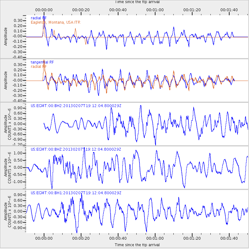
EGMT Eagleton, Montana, USA - Earthquake Result Viewer
*The percent match for this event was below the threshold and hence no stack was calculated.
| Earthquake location: |
Santa Cruz Islands |
| Earthquake latitude/longitude: |
-11.0/165.7 |
| Earthquake time(UTC): |
2013/02/07 (038) 18:59:16 GMT |
| Earthquake Depth: |
11 km |
| Earthquake Magnitude: |
6.7 MW, 6.4 MB, 6.7 MW, 6.9 MS |
| Earthquake Catalog/Contributor: |
NEIC PDE/NEIC PDE-W |
|
| Network: |
US United States National Seismic Network |
| Station: |
EGMT Eagleton, Montana, USA |
| Lat/Lon: |
48.02 N/109.75 W |
| Elevation: |
1055 m |
|
| Distance: |
94.5 deg |
| Az: |
42.096 deg |
| Baz: |
258.671 deg |
| Ray Param: |
$rayparam |
*The percent match for this event was below the threshold and hence was not used in the summary stack. |
|
| Radial Match: |
61.95994 % |
| Radial Bump: |
400 |
| Transverse Match: |
51.550297 % |
| Transverse Bump: |
400 |
| SOD ConfigId: |
558545 |
| Insert Time: |
2013-09-18 06:18:00.877 +0000 |
| GWidth: |
2.5 |
| Max Bumps: |
400 |
| Tol: |
0.001 |
|
Signal To Noise
| Channel | StoN | STA | LTA |
| US:EGMT:00:BHZ:20130207T19:12:04.800029Z | 3.947683 | 5.9020334E-7 | 1.4950626E-7 |
| US:EGMT:00:BH1:20130207T19:12:04.800029Z | 0.6320748 | 1.9108137E-7 | 3.0230817E-7 |
| US:EGMT:00:BH2:20130207T19:12:04.800029Z | 1.4418278 | 3.3179006E-7 | 2.3011769E-7 |
| Arrivals |
| Ps | |
| PpPs | |
| PsPs/PpSs | |


