You are here: Home > Network List > US - United States National Seismic Network Stations List
> Station EGMT Eagleton, Montana, USA > Earthquake Result Viewer
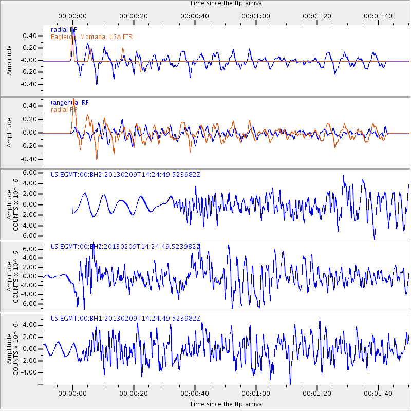
EGMT Eagleton, Montana, USA - Earthquake Result Viewer
*The percent match for this event was below the threshold and hence no stack was calculated.
| Earthquake location: |
Colombia |
| Earthquake latitude/longitude: |
1.1/-77.4 |
| Earthquake time(UTC): |
2013/02/09 (040) 14:16:07 GMT |
| Earthquake Depth: |
145 km |
| Earthquake Magnitude: |
6.7 MB, 6.9 MW, 6.9 MW |
| Earthquake Catalog/Contributor: |
WHDF/NEIC |
|
| Network: |
US United States National Seismic Network |
| Station: |
EGMT Eagleton, Montana, USA |
| Lat/Lon: |
48.02 N/109.75 W |
| Elevation: |
1055 m |
|
| Distance: |
54.4 deg |
| Az: |
333.789 deg |
| Baz: |
138.866 deg |
| Ray Param: |
$rayparam |
*The percent match for this event was below the threshold and hence was not used in the summary stack. |
|
| Radial Match: |
79.63376 % |
| Radial Bump: |
400 |
| Transverse Match: |
63.311634 % |
| Transverse Bump: |
400 |
| SOD ConfigId: |
558545 |
| Insert Time: |
2013-09-18 06:43:34.660 +0000 |
| GWidth: |
2.5 |
| Max Bumps: |
400 |
| Tol: |
0.001 |
|
Signal To Noise
| Channel | StoN | STA | LTA |
| US:EGMT:00:BHZ:20130209T14:24:49.523982Z | 4.4779015 | 3.1317143E-6 | 6.9937096E-7 |
| US:EGMT:00:BH1:20130209T14:24:49.523982Z | 1.7579336 | 1.0852993E-6 | 6.1737217E-7 |
| US:EGMT:00:BH2:20130209T14:24:49.523982Z | 0.6814036 | 8.32643E-7 | 1.2219527E-6 |
| Arrivals |
| Ps | |
| PpPs | |
| PsPs/PpSs | |


