You are here: Home > Network List > US - United States National Seismic Network Stations List
> Station MIAR Mount Ida, Arkansas, USA > Earthquake Result Viewer
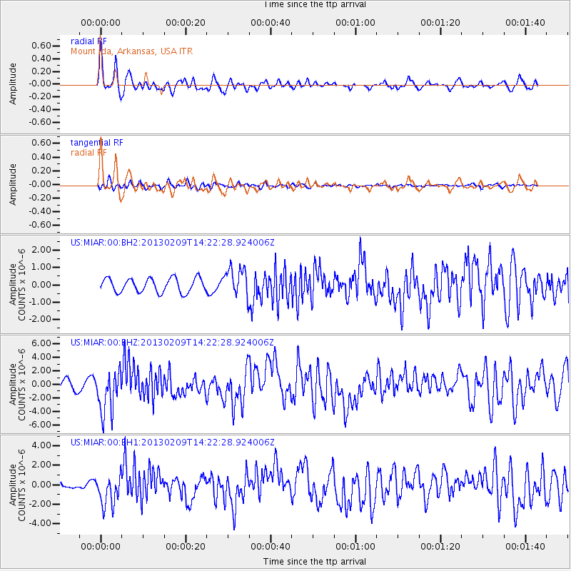
MIAR Mount Ida, Arkansas, USA - Earthquake Result Viewer
*The percent match for this event was below the threshold and hence no stack was calculated.
| Earthquake location: |
Colombia |
| Earthquake latitude/longitude: |
1.1/-77.4 |
| Earthquake time(UTC): |
2013/02/09 (040) 14:16:07 GMT |
| Earthquake Depth: |
145 km |
| Earthquake Magnitude: |
6.7 MB, 6.9 MW, 6.9 MW |
| Earthquake Catalog/Contributor: |
WHDF/NEIC |
|
| Network: |
US United States National Seismic Network |
| Station: |
MIAR Mount Ida, Arkansas, USA |
| Lat/Lon: |
34.55 N/93.58 W |
| Elevation: |
207 m |
|
| Distance: |
36.5 deg |
| Az: |
337.255 deg |
| Baz: |
152.076 deg |
| Ray Param: |
$rayparam |
*The percent match for this event was below the threshold and hence was not used in the summary stack. |
|
| Radial Match: |
79.55647 % |
| Radial Bump: |
400 |
| Transverse Match: |
63.204697 % |
| Transverse Bump: |
400 |
| SOD ConfigId: |
558545 |
| Insert Time: |
2013-09-18 06:44:35.822 +0000 |
| GWidth: |
2.5 |
| Max Bumps: |
400 |
| Tol: |
0.001 |
|
Signal To Noise
| Channel | StoN | STA | LTA |
| US:MIAR:00:BHZ:20130209T14:22:28.924006Z | 4.648057 | 3.166659E-6 | 6.812866E-7 |
| US:MIAR:00:BH1:20130209T14:22:28.924006Z | 2.8828204 | 1.6182806E-6 | 5.6135326E-7 |
| US:MIAR:00:BH2:20130209T14:22:28.924006Z | 2.0907905 | 8.43893E-7 | 4.036239E-7 |
| Arrivals |
| Ps | |
| PpPs | |
| PsPs/PpSs | |


