You are here: Home > Network List > US - United States National Seismic Network Stations List
> Station MSO Missoula, Montana, USA > Earthquake Result Viewer
MSO Missoula, Montana, USA - Earthquake Result Viewer
*The percent match for this event was below the threshold and hence no stack was calculated.
| Earthquake location: |
Colombia |
| Earthquake latitude/longitude: |
1.1/-77.4 |
| Earthquake time(UTC): |
2013/02/09 (040) 14:16:07 GMT |
| Earthquake Depth: |
145 km |
| Earthquake Magnitude: |
6.7 MB, 6.9 MW, 6.9 MW |
| Earthquake Catalog/Contributor: |
WHDF/NEIC |
|
| Network: |
US United States National Seismic Network |
| Station: |
MSO Missoula, Montana, USA |
| Lat/Lon: |
46.83 N/113.94 W |
| Elevation: |
1264 m |
|
| Distance: |
55.5 deg |
| Az: |
330.272 deg |
| Baz: |
133.775 deg |
| Ray Param: |
$rayparam |
*The percent match for this event was below the threshold and hence was not used in the summary stack. |
|
| Radial Match: |
71.23486 % |
| Radial Bump: |
400 |
| Transverse Match: |
63.095352 % |
| Transverse Bump: |
400 |
| SOD ConfigId: |
558545 |
| Insert Time: |
2013-09-18 06:44:40.787 +0000 |
| GWidth: |
2.5 |
| Max Bumps: |
400 |
| Tol: |
0.001 |
|
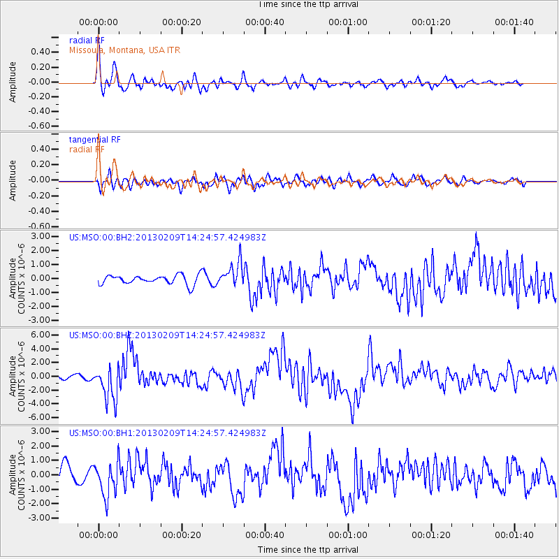
Signal To Noise
| Channel | StoN | STA | LTA |
| US:MSO:00:BHZ:20130209T14:24:57.424983Z | 8.020597 | 2.5735549E-6 | 3.2086825E-7 |
| US:MSO:00:BH1:20130209T14:24:57.424983Z | 1.7109295 | 1.2345787E-6 | 7.215836E-7 |
| US:MSO:00:BH2:20130209T14:24:57.424983Z | 2.6623821 | 8.970725E-7 | 3.3694354E-7 |
| Arrivals |
| Ps | |
| PpPs | |
| PsPs/PpSs | |


