You are here: Home > Network List > IU - Global Seismograph Network (GSN - IRIS/USGS) Stations List
> Station CTAO Charters Towers, Australia > Earthquake Result Viewer
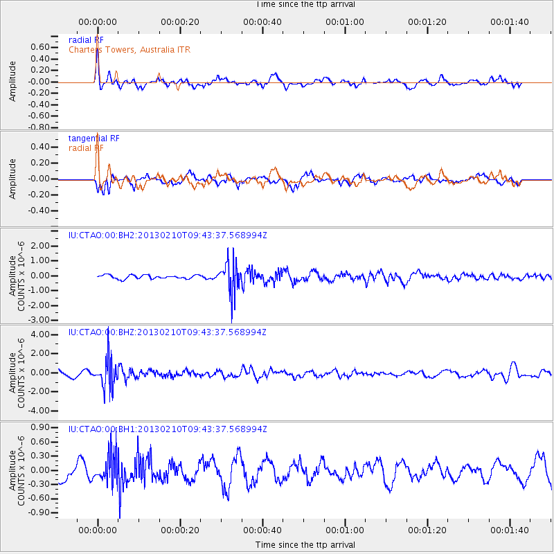
CTAO Charters Towers, Australia - Earthquake Result Viewer
*The percent match for this event was below the threshold and hence no stack was calculated.
| Earthquake location: |
Tonga Islands |
| Earthquake latitude/longitude: |
-18.6/-174.7 |
| Earthquake time(UTC): |
2013/02/10 (041) 09:37:11 GMT |
| Earthquake Depth: |
122 km |
| Earthquake Magnitude: |
5.6 MW, 5.6 MW |
| Earthquake Catalog/Contributor: |
NEIC PDE/NEIC PDE-W |
|
| Network: |
IU Global Seismograph Network (GSN - IRIS/USGS) |
| Station: |
CTAO Charters Towers, Australia |
| Lat/Lon: |
20.09 S/146.25 E |
| Elevation: |
357 m |
|
| Distance: |
36.8 deg |
| Az: |
261.143 deg |
| Baz: |
94.46 deg |
| Ray Param: |
$rayparam |
*The percent match for this event was below the threshold and hence was not used in the summary stack. |
|
| Radial Match: |
69.53156 % |
| Radial Bump: |
400 |
| Transverse Match: |
81.895706 % |
| Transverse Bump: |
400 |
| SOD ConfigId: |
558545 |
| Insert Time: |
2013-09-18 06:53:54.218 +0000 |
| GWidth: |
2.5 |
| Max Bumps: |
400 |
| Tol: |
0.001 |
|
Signal To Noise
| Channel | StoN | STA | LTA |
| IU:CTAO:00:BHZ:20130210T09:43:37.568994Z | 5.1684794 | 1.5237706E-6 | 2.948199E-7 |
| IU:CTAO:00:BH1:20130210T09:43:37.568994Z | 2.5907383 | 3.0684913E-7 | 1.18440816E-7 |
| IU:CTAO:00:BH2:20130210T09:43:37.568994Z | 8.249545 | 1.0256704E-6 | 1.2433053E-7 |
| Arrivals |
| Ps | |
| PpPs | |
| PsPs/PpSs | |


