You are here: Home > Network List > IU - Global Seismograph Network (GSN - IRIS/USGS) Stations List
> Station TEIG Tepich, Yucatan, Mexico > Earthquake Result Viewer
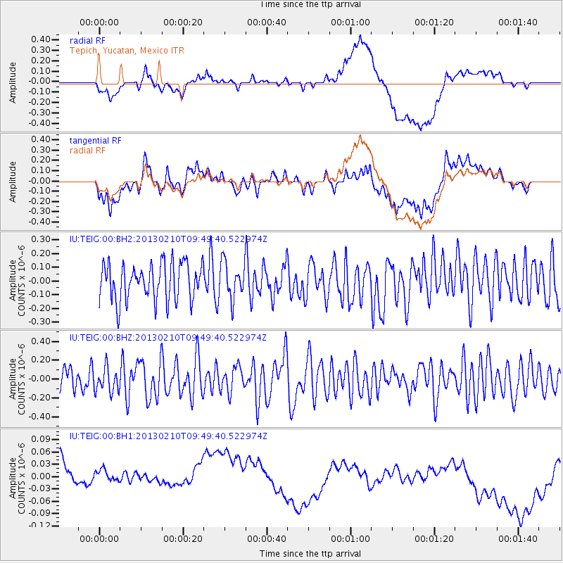
TEIG Tepich, Yucatan, Mexico - Earthquake Result Viewer
*The percent match for this event was below the threshold and hence no stack was calculated.
| Earthquake location: |
Tonga Islands |
| Earthquake latitude/longitude: |
-18.6/-174.7 |
| Earthquake time(UTC): |
2013/02/10 (041) 09:37:11 GMT |
| Earthquake Depth: |
122 km |
| Earthquake Magnitude: |
5.6 MW, 5.6 MW |
| Earthquake Catalog/Contributor: |
NEIC PDE/NEIC PDE-W |
|
| Network: |
IU Global Seismograph Network (GSN - IRIS/USGS) |
| Station: |
TEIG Tepich, Yucatan, Mexico |
| Lat/Lon: |
20.23 N/88.28 W |
| Elevation: |
40 m |
|
| Distance: |
93.1 deg |
| Az: |
69.821 deg |
| Baz: |
251.424 deg |
| Ray Param: |
$rayparam |
*The percent match for this event was below the threshold and hence was not used in the summary stack. |
|
| Radial Match: |
35.226986 % |
| Radial Bump: |
400 |
| Transverse Match: |
35.155262 % |
| Transverse Bump: |
400 |
| SOD ConfigId: |
558545 |
| Insert Time: |
2013-09-18 06:54:35.806 +0000 |
| GWidth: |
2.5 |
| Max Bumps: |
400 |
| Tol: |
0.001 |
|
Signal To Noise
| Channel | StoN | STA | LTA |
| IU:TEIG:00:BHZ:20130210T09:49:40.522974Z | 0.8339841 | 1.2832463E-7 | 1.538694E-7 |
| IU:TEIG:00:BH1:20130210T09:49:40.522974Z | 0.7149476 | 5.990024E-8 | 8.3782695E-8 |
| IU:TEIG:00:BH2:20130210T09:49:40.522974Z | 1.0040214 | 1.342201E-7 | 1.3368252E-7 |
| Arrivals |
| Ps | |
| PpPs | |
| PsPs/PpSs | |


