You are here: Home > Network List > II - Global Seismograph Network (GSN - IRIS/IDA) Stations List
> Station NIL Nilore, Pakistan > Earthquake Result Viewer
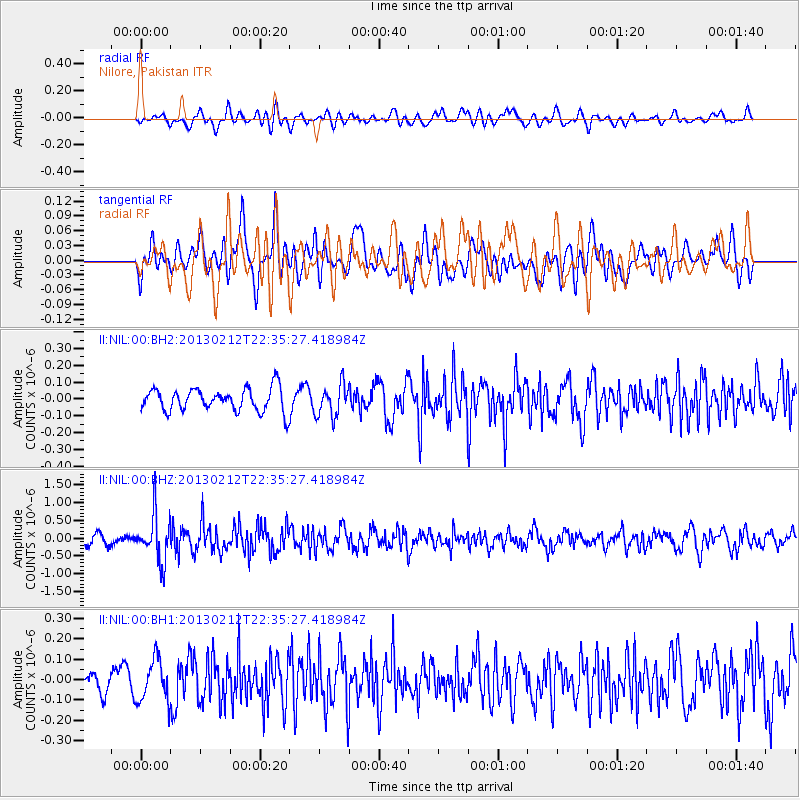
NIL Nilore, Pakistan - Earthquake Result Viewer
*The percent match for this event was below the threshold and hence no stack was calculated.
| Earthquake location: |
Tanimbar Islands Reg., Indonesia |
| Earthquake latitude/longitude: |
-6.9/131.4 |
| Earthquake time(UTC): |
2013/02/12 (043) 22:25:03 GMT |
| Earthquake Depth: |
54 km |
| Earthquake Magnitude: |
5.6 MB, 5.3 MW |
| Earthquake Catalog/Contributor: |
WHDF/NEIC |
|
| Network: |
II Global Seismograph Network (GSN - IRIS/IDA) |
| Station: |
NIL Nilore, Pakistan |
| Lat/Lon: |
33.65 N/73.27 E |
| Elevation: |
629 m |
|
| Distance: |
68.2 deg |
| Az: |
310.292 deg |
| Baz: |
114.786 deg |
| Ray Param: |
$rayparam |
*The percent match for this event was below the threshold and hence was not used in the summary stack. |
|
| Radial Match: |
64.10011 % |
| Radial Bump: |
400 |
| Transverse Match: |
54.738197 % |
| Transverse Bump: |
400 |
| SOD ConfigId: |
558545 |
| Insert Time: |
2013-09-18 07:05:57.638 +0000 |
| GWidth: |
2.5 |
| Max Bumps: |
400 |
| Tol: |
0.001 |
|
Signal To Noise
| Channel | StoN | STA | LTA |
| II:NIL:00:BHZ:20130212T22:35:27.418984Z | 4.783252 | 6.733286E-7 | 1.4076797E-7 |
| II:NIL:00:BH1:20130212T22:35:27.418984Z | 1.8085258 | 1.0421409E-7 | 5.762378E-8 |
| II:NIL:00:BH2:20130212T22:35:27.418984Z | 1.3718681 | 9.365009E-8 | 6.826465E-8 |
| Arrivals |
| Ps | |
| PpPs | |
| PsPs/PpSs | |


