You are here: Home > Network List > US - United States National Seismic Network Stations List
> Station HAWA Hanford, Washington, USA > Earthquake Result Viewer
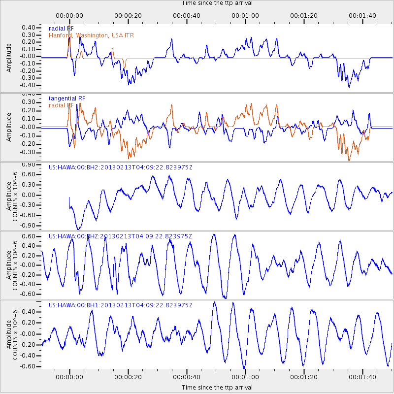
HAWA Hanford, Washington, USA - Earthquake Result Viewer
*The percent match for this event was below the threshold and hence no stack was calculated.
| Earthquake location: |
Kyushu, Japan |
| Earthquake latitude/longitude: |
30.3/131.4 |
| Earthquake time(UTC): |
2013/02/13 (044) 03:57:42 GMT |
| Earthquake Depth: |
10 km |
| Earthquake Magnitude: |
5.5 MB, 5.1 MS, 5.2 MW, 5.4 MW |
| Earthquake Catalog/Contributor: |
WHDF/NEIC |
|
| Network: |
US United States National Seismic Network |
| Station: |
HAWA Hanford, Washington, USA |
| Lat/Lon: |
46.39 N/119.53 W |
| Elevation: |
364 m |
|
| Distance: |
80.4 deg |
| Az: |
41.563 deg |
| Baz: |
303.961 deg |
| Ray Param: |
$rayparam |
*The percent match for this event was below the threshold and hence was not used in the summary stack. |
|
| Radial Match: |
46.642696 % |
| Radial Bump: |
400 |
| Transverse Match: |
47.19889 % |
| Transverse Bump: |
400 |
| SOD ConfigId: |
558545 |
| Insert Time: |
2013-09-18 07:11:27.995 +0000 |
| GWidth: |
2.5 |
| Max Bumps: |
400 |
| Tol: |
0.001 |
|
Signal To Noise
| Channel | StoN | STA | LTA |
| US:HAWA:00:BHZ:20130213T04:09:22.823975Z | 1.6702744 | 3.936729E-7 | 2.3569356E-7 |
| US:HAWA:00:BH1:20130213T04:09:22.823975Z | 0.5346181 | 1.145948E-7 | 2.143489E-7 |
| US:HAWA:00:BH2:20130213T04:09:22.823975Z | 1.5052234 | 5.3028356E-7 | 3.522956E-7 |
| Arrivals |
| Ps | |
| PpPs | |
| PsPs/PpSs | |


