You are here: Home > Network List > TA - USArray Transportable Network (new EarthScope stations) Stations List
> Station T56A Rocky Mt, VA, USA > Earthquake Result Viewer
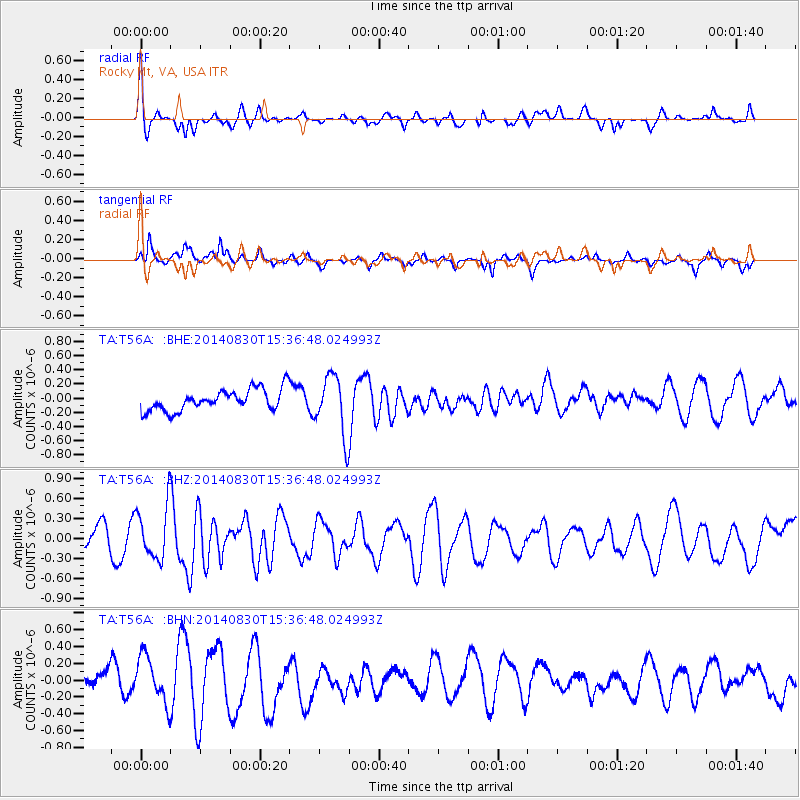
T56A Rocky Mt, VA, USA - Earthquake Result Viewer
*The percent match for this event was below the threshold and hence no stack was calculated.
| Earthquake location: |
Northern Mid-Atlantic Ridge |
| Earthquake latitude/longitude: |
43.7/-28.5 |
| Earthquake time(UTC): |
2014/08/30 (242) 15:29:50 GMT |
| Earthquake Depth: |
10 km |
| Earthquake Magnitude: |
5.5 MW, 5.3 mb, 5.2 Ms_20, 5.4 Mwb, 5.5 Mwc |
| Earthquake Catalog/Contributor: |
ISC/ISC |
|
| Network: |
TA USArray Transportable Network (new EarthScope stations) |
| Station: |
T56A Rocky Mt, VA, USA |
| Lat/Lon: |
37.03 N/80.03 W |
| Elevation: |
387 m |
|
| Distance: |
39.3 deg |
| Az: |
278.305 deg |
| Baz: |
63.678 deg |
| Ray Param: |
$rayparam |
*The percent match for this event was below the threshold and hence was not used in the summary stack. |
|
| Radial Match: |
54.54678 % |
| Radial Bump: |
334 |
| Transverse Match: |
67.89256 % |
| Transverse Bump: |
303 |
| SOD ConfigId: |
3390531 |
| Insert Time: |
2019-04-13 17:43:06.782 +0000 |
| GWidth: |
2.5 |
| Max Bumps: |
400 |
| Tol: |
0.001 |
|
Signal To Noise
| Channel | StoN | STA | LTA |
| TA:T56A: :BHZ:20140830T15:36:48.024993Z | 1.5427798 | 3.972747E-7 | 2.5750577E-7 |
| TA:T56A: :BHN:20140830T15:36:48.024993Z | 1.4723939 | 2.8511585E-7 | 1.9364101E-7 |
| TA:T56A: :BHE:20140830T15:36:48.024993Z | 2.7771266 | 4.1709677E-7 | 1.5019006E-7 |
| Arrivals |
| Ps | |
| PpPs | |
| PsPs/PpSs | |


