You are here: Home > Network List > TA - USArray Transportable Network (new EarthScope stations) Stations List
> Station V61A Roper, NC, USA > Earthquake Result Viewer
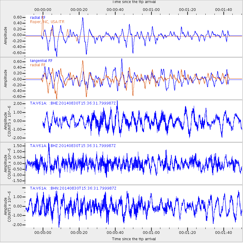
V61A Roper, NC, USA - Earthquake Result Viewer
*The percent match for this event was below the threshold and hence no stack was calculated.
| Earthquake location: |
Northern Mid-Atlantic Ridge |
| Earthquake latitude/longitude: |
43.7/-28.5 |
| Earthquake time(UTC): |
2014/08/30 (242) 15:29:50 GMT |
| Earthquake Depth: |
10 km |
| Earthquake Magnitude: |
5.5 MW, 5.3 mb, 5.2 Ms_20, 5.4 Mwb, 5.5 Mwc |
| Earthquake Catalog/Contributor: |
ISC/ISC |
|
| Network: |
TA USArray Transportable Network (new EarthScope stations) |
| Station: |
V61A Roper, NC, USA |
| Lat/Lon: |
35.79 N/76.58 W |
| Elevation: |
4.0 m |
|
| Distance: |
37.3 deg |
| Az: |
274.5 deg |
| Baz: |
62.732 deg |
| Ray Param: |
$rayparam |
*The percent match for this event was below the threshold and hence was not used in the summary stack. |
|
| Radial Match: |
58.47516 % |
| Radial Bump: |
328 |
| Transverse Match: |
65.52524 % |
| Transverse Bump: |
400 |
| SOD ConfigId: |
3390531 |
| Insert Time: |
2019-04-13 17:43:12.747 +0000 |
| GWidth: |
2.5 |
| Max Bumps: |
400 |
| Tol: |
0.001 |
|
Signal To Noise
| Channel | StoN | STA | LTA |
| TA:V61A: :BHZ:20140830T15:36:31.799987Z | 1.608272 | 5.900801E-7 | 3.6690318E-7 |
| TA:V61A: :BHN:20140830T15:36:31.799987Z | 1.3886545 | 6.564633E-7 | 4.727334E-7 |
| TA:V61A: :BHE:20140830T15:36:31.799987Z | 1.3230414 | 6.65146E-7 | 5.0274014E-7 |
| Arrivals |
| Ps | |
| PpPs | |
| PsPs/PpSs | |


