You are here: Home > Network List > TA - USArray Transportable Network (new EarthScope stations) Stations List
> Station Z41A Richland Creek Farm, El Dorado, AR, USA > Earthquake Result Viewer
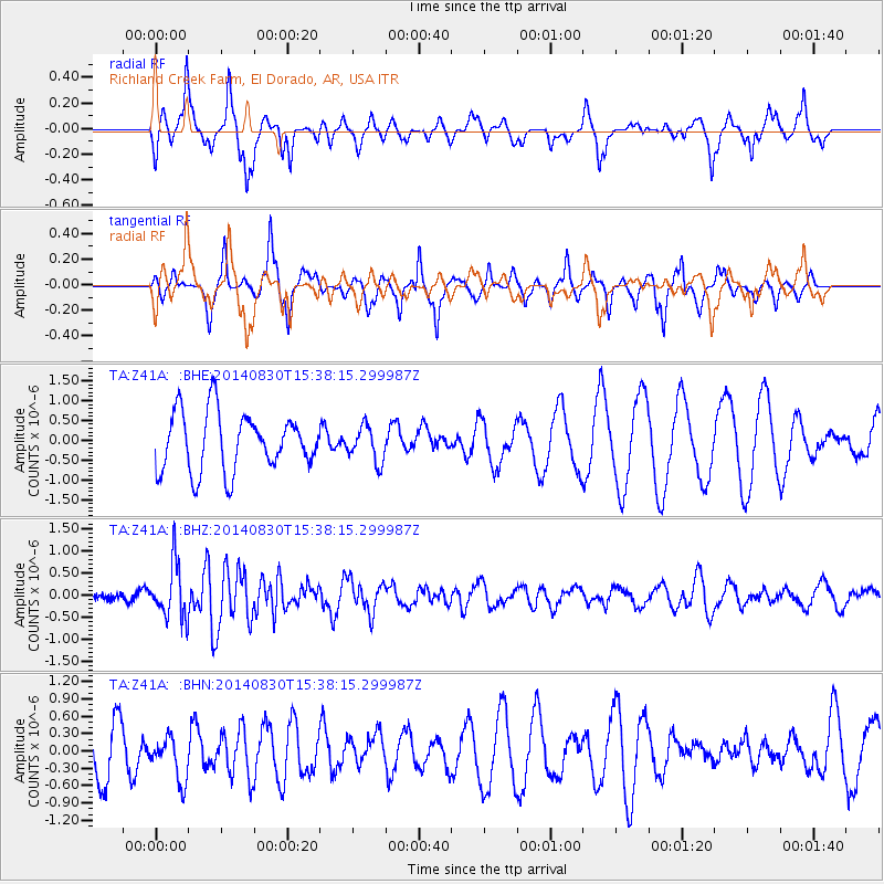
Z41A Richland Creek Farm, El Dorado, AR, USA - Earthquake Result Viewer
*The percent match for this event was below the threshold and hence no stack was calculated.
| Earthquake location: |
Northern Mid-Atlantic Ridge |
| Earthquake latitude/longitude: |
43.7/-28.5 |
| Earthquake time(UTC): |
2014/08/30 (242) 15:29:50 GMT |
| Earthquake Depth: |
10 km |
| Earthquake Magnitude: |
5.5 MW, 5.3 mb, 5.2 Ms_20, 5.4 Mwb, 5.5 Mwc |
| Earthquake Catalog/Contributor: |
ISC/ISC |
|
| Network: |
TA USArray Transportable Network (new EarthScope stations) |
| Station: |
Z41A Richland Creek Farm, El Dorado, AR, USA |
| Lat/Lon: |
33.26 N/92.80 W |
| Elevation: |
62 m |
|
| Distance: |
50.2 deg |
| Az: |
280.875 deg |
| Baz: |
58.169 deg |
| Ray Param: |
$rayparam |
*The percent match for this event was below the threshold and hence was not used in the summary stack. |
|
| Radial Match: |
40.14259 % |
| Radial Bump: |
333 |
| Transverse Match: |
44.86063 % |
| Transverse Bump: |
275 |
| SOD ConfigId: |
3390531 |
| Insert Time: |
2019-04-13 17:43:18.670 +0000 |
| GWidth: |
2.5 |
| Max Bumps: |
400 |
| Tol: |
0.001 |
|
Signal To Noise
| Channel | StoN | STA | LTA |
| TA:Z41A: :BHZ:20140830T15:38:15.299987Z | 3.4601884 | 6.119364E-7 | 1.768506E-7 |
| TA:Z41A: :BHN:20140830T15:38:15.299987Z | 1.0060751 | 3.8763827E-7 | 3.8529754E-7 |
| TA:Z41A: :BHE:20140830T15:38:15.299987Z | 0.6064689 | 4.4240306E-7 | 7.2947364E-7 |
| Arrivals |
| Ps | |
| PpPs | |
| PsPs/PpSs | |


