You are here: Home > Network List > IU - Global Seismograph Network (GSN - IRIS/USGS) Stations List
> Station HNR Honiara, Solomon Islands > Earthquake Result Viewer
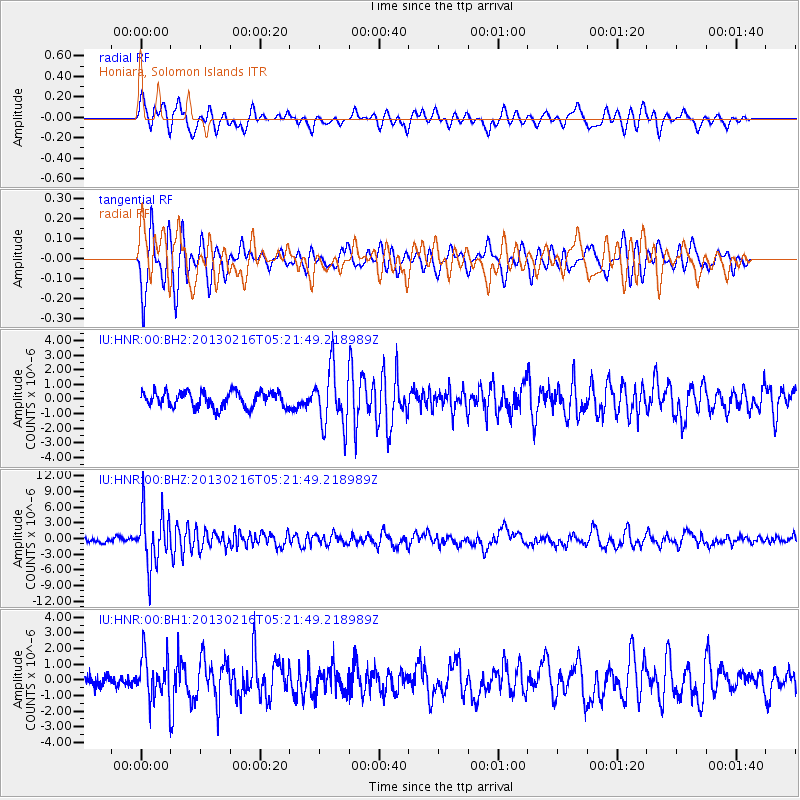
HNR Honiara, Solomon Islands - Earthquake Result Viewer
*The percent match for this event was below the threshold and hence no stack was calculated.
| Earthquake location: |
Off E. Coast Of N. Island, N.Z. |
| Earthquake latitude/longitude: |
-36.5/177.9 |
| Earthquake time(UTC): |
2013/02/16 (047) 05:16:17 GMT |
| Earthquake Depth: |
207 km |
| Earthquake Magnitude: |
5.7 MB, 5.8 MW, 5.8 MW |
| Earthquake Catalog/Contributor: |
WHDF/NEIC |
|
| Network: |
IU Global Seismograph Network (GSN - IRIS/USGS) |
| Station: |
HNR Honiara, Solomon Islands |
| Lat/Lon: |
9.44 S/159.95 E |
| Elevation: |
100 m |
|
| Distance: |
31.5 deg |
| Az: |
324.347 deg |
| Baz: |
151.58 deg |
| Ray Param: |
$rayparam |
*The percent match for this event was below the threshold and hence was not used in the summary stack. |
|
| Radial Match: |
75.04841 % |
| Radial Bump: |
400 |
| Transverse Match: |
77.1329 % |
| Transverse Bump: |
390 |
| SOD ConfigId: |
558545 |
| Insert Time: |
2013-09-18 07:30:14.035 +0000 |
| GWidth: |
2.5 |
| Max Bumps: |
400 |
| Tol: |
0.001 |
|
Signal To Noise
| Channel | StoN | STA | LTA |
| IU:HNR:00:BHZ:20130216T05:21:49.218989Z | 12.152946 | 5.1870766E-6 | 4.2681637E-7 |
| IU:HNR:00:BH1:20130216T05:21:49.218989Z | 3.535163 | 1.4244545E-6 | 4.0293887E-7 |
| IU:HNR:00:BH2:20130216T05:21:49.218989Z | 3.7376318 | 1.9599338E-6 | 5.2437855E-7 |
| Arrivals |
| Ps | |
| PpPs | |
| PsPs/PpSs | |


