You are here: Home > Network List > IU - Global Seismograph Network (GSN - IRIS/USGS) Stations List
> Station POHA Pohakuloa, Hawaii, USA > Earthquake Result Viewer
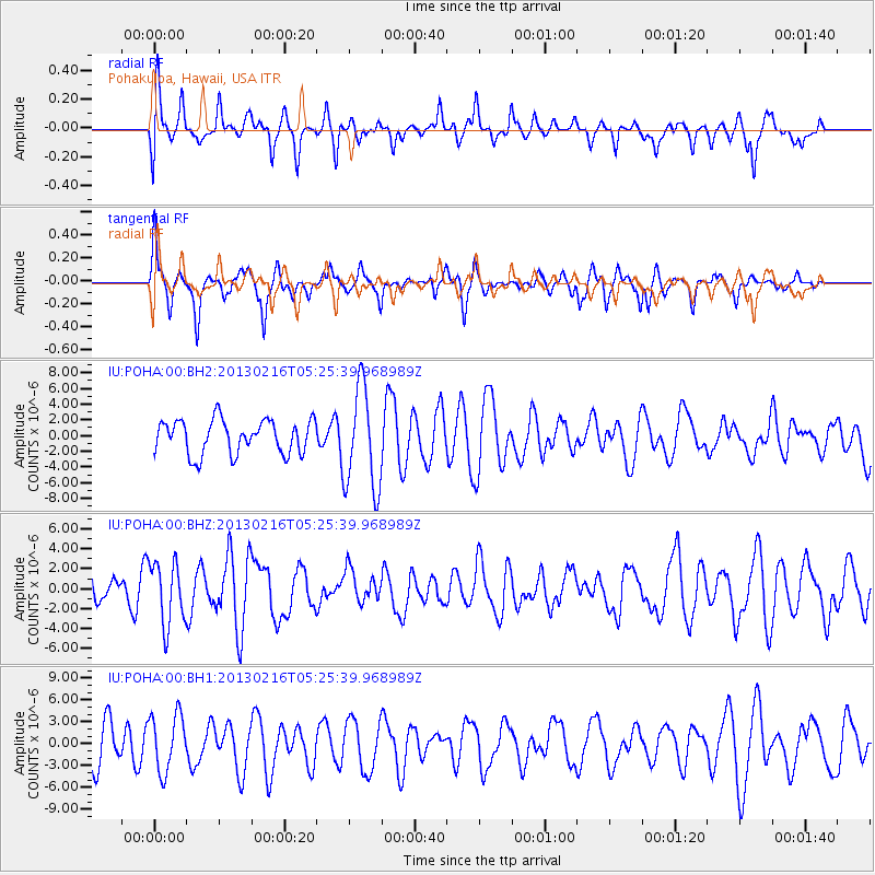
POHA Pohakuloa, Hawaii, USA - Earthquake Result Viewer
*The percent match for this event was below the threshold and hence no stack was calculated.
| Earthquake location: |
Off E. Coast Of N. Island, N.Z. |
| Earthquake latitude/longitude: |
-36.5/177.9 |
| Earthquake time(UTC): |
2013/02/16 (047) 05:16:17 GMT |
| Earthquake Depth: |
207 km |
| Earthquake Magnitude: |
5.7 MB, 5.8 MW, 5.8 MW |
| Earthquake Catalog/Contributor: |
WHDF/NEIC |
|
| Network: |
IU Global Seismograph Network (GSN - IRIS/USGS) |
| Station: |
POHA Pohakuloa, Hawaii, USA |
| Lat/Lon: |
19.76 N/155.53 W |
| Elevation: |
1990 m |
|
| Distance: |
61.3 deg |
| Az: |
28.656 deg |
| Baz: |
204.217 deg |
| Ray Param: |
$rayparam |
*The percent match for this event was below the threshold and hence was not used in the summary stack. |
|
| Radial Match: |
49.52843 % |
| Radial Bump: |
400 |
| Transverse Match: |
58.774525 % |
| Transverse Bump: |
338 |
| SOD ConfigId: |
558545 |
| Insert Time: |
2013-09-18 07:30:27.429 +0000 |
| GWidth: |
2.5 |
| Max Bumps: |
400 |
| Tol: |
0.001 |
|
Signal To Noise
| Channel | StoN | STA | LTA |
| IU:POHA:00:BHZ:20130216T05:25:39.968989Z | 1.7412981 | 3.129607E-6 | 1.7972837E-6 |
| IU:POHA:00:BH1:20130216T05:25:39.968989Z | 1.0888704 | 3.8783073E-6 | 3.5617713E-6 |
| IU:POHA:00:BH2:20130216T05:25:39.968989Z | 3.024396 | 6.5118115E-6 | 2.153095E-6 |
| Arrivals |
| Ps | |
| PpPs | |
| PsPs/PpSs | |


