You are here: Home > Network List > US - United States National Seismic Network Stations List
> Station WRAK Wrangell Island, Southeastern Alaska, Alaska, USA > Earthquake Result Viewer
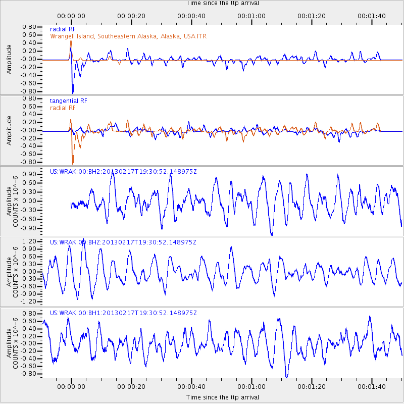
WRAK Wrangell Island, Southeastern Alaska, Alaska, USA - Earthquake Result Viewer
*The percent match for this event was below the threshold and hence no stack was calculated.
| Earthquake location: |
Santa Cruz Islands |
| Earthquake latitude/longitude: |
-10.8/165.7 |
| Earthquake time(UTC): |
2013/02/17 (048) 19:18:52 GMT |
| Earthquake Depth: |
10 km |
| Earthquake Magnitude: |
5.5 MW, 5.5 MW |
| Earthquake Catalog/Contributor: |
NEIC PDE/NEIC PDE-W |
|
| Network: |
US United States National Seismic Network |
| Station: |
WRAK Wrangell Island, Southeastern Alaska, Alaska, USA |
| Lat/Lon: |
56.42 N/132.35 W |
| Elevation: |
81 m |
|
| Distance: |
84.2 deg |
| Az: |
29.544 deg |
| Baz: |
240.657 deg |
| Ray Param: |
$rayparam |
*The percent match for this event was below the threshold and hence was not used in the summary stack. |
|
| Radial Match: |
79.25103 % |
| Radial Bump: |
400 |
| Transverse Match: |
56.24808 % |
| Transverse Bump: |
400 |
| SOD ConfigId: |
558545 |
| Insert Time: |
2013-09-18 07:36:00.086 +0000 |
| GWidth: |
2.5 |
| Max Bumps: |
400 |
| Tol: |
0.001 |
|
Signal To Noise
| Channel | StoN | STA | LTA |
| US:WRAK:00:BHZ:20130217T19:30:52.148975Z | 2.41301 | 8.164189E-7 | 3.3834047E-7 |
| US:WRAK:00:BH1:20130217T19:30:52.148975Z | 0.8418146 | 2.774081E-7 | 3.2953588E-7 |
| US:WRAK:00:BH2:20130217T19:30:52.148975Z | 1.6631902 | 5.471434E-7 | 3.2897222E-7 |
| Arrivals |
| Ps | |
| PpPs | |
| PsPs/PpSs | |


