You are here: Home > Network List > II - Global Seismograph Network (GSN - IRIS/IDA) Stations List
> Station WRAB Tennant Creek, NT, Australia > Earthquake Result Viewer
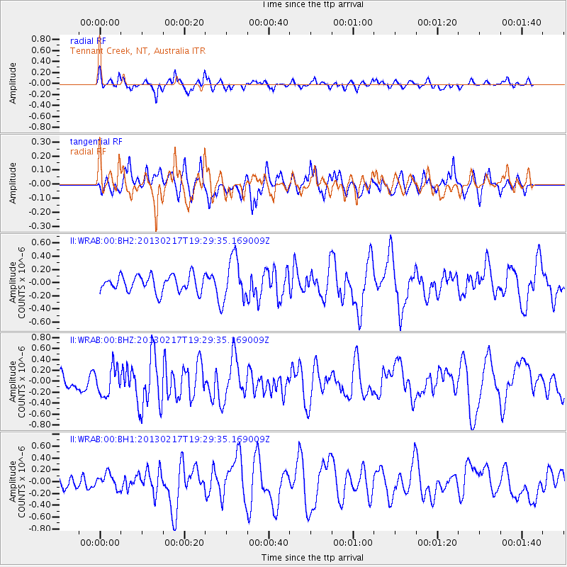
WRAB Tennant Creek, NT, Australia - Earthquake Result Viewer
*The percent match for this event was below the threshold and hence no stack was calculated.
| Earthquake location: |
Santa Cruz Islands |
| Earthquake latitude/longitude: |
-10.8/165.6 |
| Earthquake time(UTC): |
2013/02/17 (048) 19:23:45 GMT |
| Earthquake Depth: |
10 km |
| Earthquake Magnitude: |
5.7 MW, 5.6 MW |
| Earthquake Catalog/Contributor: |
NEIC PDE/NEIC PDE-W |
|
| Network: |
II Global Seismograph Network (GSN - IRIS/IDA) |
| Station: |
WRAB Tennant Creek, NT, Australia |
| Lat/Lon: |
19.93 S/134.36 E |
| Elevation: |
366 m |
|
| Distance: |
31.4 deg |
| Az: |
249.413 deg |
| Baz: |
77.851 deg |
| Ray Param: |
$rayparam |
*The percent match for this event was below the threshold and hence was not used in the summary stack. |
|
| Radial Match: |
60.61348 % |
| Radial Bump: |
343 |
| Transverse Match: |
43.60917 % |
| Transverse Bump: |
400 |
| SOD ConfigId: |
558545 |
| Insert Time: |
2013-09-18 07:36:32.995 +0000 |
| GWidth: |
2.5 |
| Max Bumps: |
400 |
| Tol: |
0.001 |
|
Signal To Noise
| Channel | StoN | STA | LTA |
| II:WRAB:00:BHZ:20130217T19:29:35.169009Z | 1.2723489 | 2.527877E-7 | 1.9867798E-7 |
| II:WRAB:00:BH1:20130217T19:29:35.169009Z | 0.94311786 | 1.2607478E-7 | 1.3367871E-7 |
| II:WRAB:00:BH2:20130217T19:29:35.169009Z | 2.6606517 | 3.258298E-7 | 1.2246241E-7 |
| Arrivals |
| Ps | |
| PpPs | |
| PsPs/PpSs | |


