You are here: Home > Network List > IU - Global Seismograph Network (GSN - IRIS/USGS) Stations List
> Station JOHN Johnston Island, USA > Earthquake Result Viewer
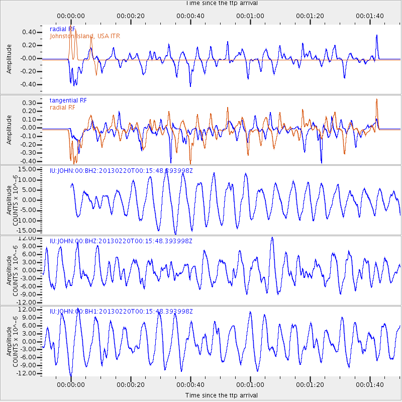
JOHN Johnston Island, USA - Earthquake Result Viewer
*The percent match for this event was below the threshold and hence no stack was calculated.
| Earthquake location: |
Santa Cruz Islands |
| Earthquake latitude/longitude: |
-10.8/166.9 |
| Earthquake time(UTC): |
2013/02/20 (051) 00:09:18 GMT |
| Earthquake Depth: |
6.0 km |
| Earthquake Magnitude: |
5.5 MB, 5.4 MS, 5.6 MW, 5.6 MW |
| Earthquake Catalog/Contributor: |
WHDF/NEIC |
|
| Network: |
IU Global Seismograph Network (GSN - IRIS/USGS) |
| Station: |
JOHN Johnston Island, USA |
| Lat/Lon: |
16.73 N/169.53 W |
| Elevation: |
2.0 m |
|
| Distance: |
35.9 deg |
| Az: |
40.767 deg |
| Baz: |
222.037 deg |
| Ray Param: |
$rayparam |
*The percent match for this event was below the threshold and hence was not used in the summary stack. |
|
| Radial Match: |
34.497158 % |
| Radial Bump: |
349 |
| Transverse Match: |
49.878593 % |
| Transverse Bump: |
400 |
| SOD ConfigId: |
558545 |
| Insert Time: |
2013-09-18 07:52:43.497 +0000 |
| GWidth: |
2.5 |
| Max Bumps: |
400 |
| Tol: |
0.001 |
|
Signal To Noise
| Channel | StoN | STA | LTA |
| IU:JOHN:00:BHZ:20130220T00:15:48.393998Z | 1.3663918 | 4.767613E-6 | 3.4891991E-6 |
| IU:JOHN:00:BH1:20130220T00:15:48.393998Z | 2.471956 | 8.330209E-6 | 3.3698857E-6 |
| IU:JOHN:00:BH2:20130220T00:15:48.393998Z | 2.2057462 | 1.0486477E-5 | 4.754163E-6 |
| Arrivals |
| Ps | |
| PpPs | |
| PsPs/PpSs | |


