You are here: Home > Network List > US - United States National Seismic Network Stations List
> Station DUG Dugway, Tooele County, Utah, USA > Earthquake Result Viewer
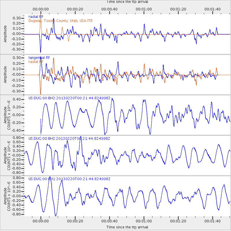
DUG Dugway, Tooele County, Utah, USA - Earthquake Result Viewer
*The percent match for this event was below the threshold and hence no stack was calculated.
| Earthquake location: |
Santa Cruz Islands |
| Earthquake latitude/longitude: |
-10.8/166.9 |
| Earthquake time(UTC): |
2013/02/20 (051) 00:09:18 GMT |
| Earthquake Depth: |
6.0 km |
| Earthquake Magnitude: |
5.5 MB, 5.4 MS, 5.6 MW, 5.6 MW |
| Earthquake Catalog/Contributor: |
WHDF/NEIC |
|
| Network: |
US United States National Seismic Network |
| Station: |
DUG Dugway, Tooele County, Utah, USA |
| Lat/Lon: |
40.19 N/112.81 W |
| Elevation: |
1477 m |
|
| Distance: |
89.6 deg |
| Az: |
49.027 deg |
| Baz: |
255.584 deg |
| Ray Param: |
$rayparam |
*The percent match for this event was below the threshold and hence was not used in the summary stack. |
|
| Radial Match: |
51.956078 % |
| Radial Bump: |
400 |
| Transverse Match: |
42.82709 % |
| Transverse Bump: |
400 |
| SOD ConfigId: |
558545 |
| Insert Time: |
2013-09-18 07:53:35.617 +0000 |
| GWidth: |
2.5 |
| Max Bumps: |
400 |
| Tol: |
0.001 |
|
Signal To Noise
| Channel | StoN | STA | LTA |
| US:DUG:00:BHZ:20130220T00:21:44.824998Z | 2.226365 | 4.7985174E-7 | 2.1553146E-7 |
| US:DUG:00:BH1:20130220T00:21:44.824998Z | 2.5968087 | 4.521662E-7 | 1.7412381E-7 |
| US:DUG:00:BH2:20130220T00:21:44.824998Z | 1.193377 | 2.694035E-7 | 2.2574885E-7 |
| Arrivals |
| Ps | |
| PpPs | |
| PsPs/PpSs | |


