You are here: Home > Network List > CU - Caribbean Network (USGS) Stations List
> Station BBGH Gun Hill, Barbados > Earthquake Result Viewer
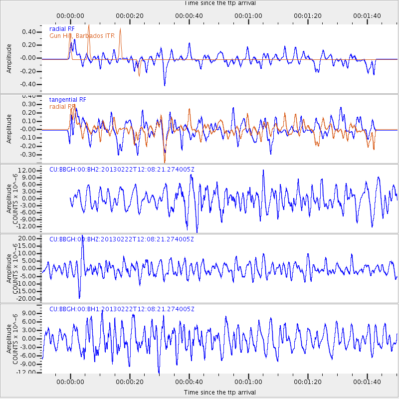
BBGH Gun Hill, Barbados - Earthquake Result Viewer
*The percent match for this event was below the threshold and hence no stack was calculated.
| Earthquake location: |
Santiago Del Estero Prov., Arg. |
| Earthquake latitude/longitude: |
-27.9/-63.1 |
| Earthquake time(UTC): |
2013/02/22 (053) 12:01:58 GMT |
| Earthquake Depth: |
575 km |
| Earthquake Magnitude: |
5.8 MB, 6.1 MW, 6.2 MW |
| Earthquake Catalog/Contributor: |
WHDF/NEIC |
|
| Network: |
CU Caribbean Network (USGS) |
| Station: |
BBGH Gun Hill, Barbados |
| Lat/Lon: |
13.14 N/59.56 W |
| Elevation: |
180 m |
|
| Distance: |
41.0 deg |
| Az: |
5.26 deg |
| Baz: |
184.777 deg |
| Ray Param: |
$rayparam |
*The percent match for this event was below the threshold and hence was not used in the summary stack. |
|
| Radial Match: |
43.41702 % |
| Radial Bump: |
400 |
| Transverse Match: |
51.955727 % |
| Transverse Bump: |
400 |
| SOD ConfigId: |
558545 |
| Insert Time: |
2013-09-18 07:55:57.355 +0000 |
| GWidth: |
2.5 |
| Max Bumps: |
400 |
| Tol: |
0.001 |
|
Signal To Noise
| Channel | StoN | STA | LTA |
| CU:BBGH:00:BHZ:20130222T12:08:21.274005Z | 2.985001 | 9.061294E-6 | 3.0356082E-6 |
| CU:BBGH:00:BH1:20130222T12:08:21.274005Z | 1.404389 | 3.8148883E-6 | 2.7164042E-6 |
| CU:BBGH:00:BH2:20130222T12:08:21.274005Z | 1.2075312 | 4.11311E-6 | 3.4062143E-6 |
| Arrivals |
| Ps | |
| PpPs | |
| PsPs/PpSs | |


