You are here: Home > Network List > US - United States National Seismic Network Stations List
> Station DGMT Dagmar, Montana, USA > Earthquake Result Viewer
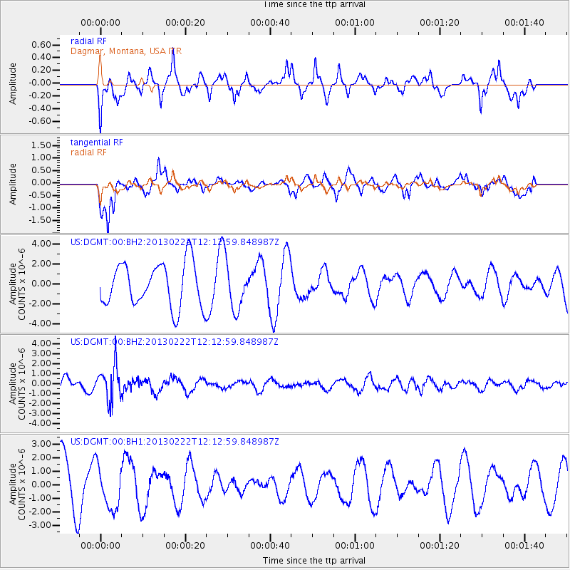
DGMT Dagmar, Montana, USA - Earthquake Result Viewer
*The percent match for this event was below the threshold and hence no stack was calculated.
| Earthquake location: |
Santiago Del Estero Prov., Arg. |
| Earthquake latitude/longitude: |
-27.9/-63.1 |
| Earthquake time(UTC): |
2013/02/22 (053) 12:01:58 GMT |
| Earthquake Depth: |
575 km |
| Earthquake Magnitude: |
5.8 MB, 6.1 MW, 6.2 MW |
| Earthquake Catalog/Contributor: |
WHDF/NEIC |
|
| Network: |
US United States National Seismic Network |
| Station: |
DGMT Dagmar, Montana, USA |
| Lat/Lon: |
48.47 N/104.20 W |
| Elevation: |
0.0 m |
|
| Distance: |
84.5 deg |
| Az: |
333.928 deg |
| Baz: |
144.245 deg |
| Ray Param: |
$rayparam |
*The percent match for this event was below the threshold and hence was not used in the summary stack. |
|
| Radial Match: |
54.524567 % |
| Radial Bump: |
400 |
| Transverse Match: |
70.505806 % |
| Transverse Bump: |
400 |
| SOD ConfigId: |
558545 |
| Insert Time: |
2013-09-18 07:58:48.849 +0000 |
| GWidth: |
2.5 |
| Max Bumps: |
400 |
| Tol: |
0.001 |
|
Signal To Noise
| Channel | StoN | STA | LTA |
| US:DGMT:00:BHZ:20130222T12:12:59.848987Z | 3.2749395 | 1.6878155E-6 | 5.15373E-7 |
| US:DGMT:00:BH1:20130222T12:12:59.848987Z | 0.53216094 | 1.512666E-6 | 2.8424972E-6 |
| US:DGMT:00:BH2:20130222T12:12:59.848987Z | 1.1133997 | 2.4191804E-6 | 2.172787E-6 |
| Arrivals |
| Ps | |
| PpPs | |
| PsPs/PpSs | |


