You are here: Home > Network List > TA - USArray Transportable Network (new EarthScope stations) Stations List
> Station L53A Girard, PA, USA > Earthquake Result Viewer
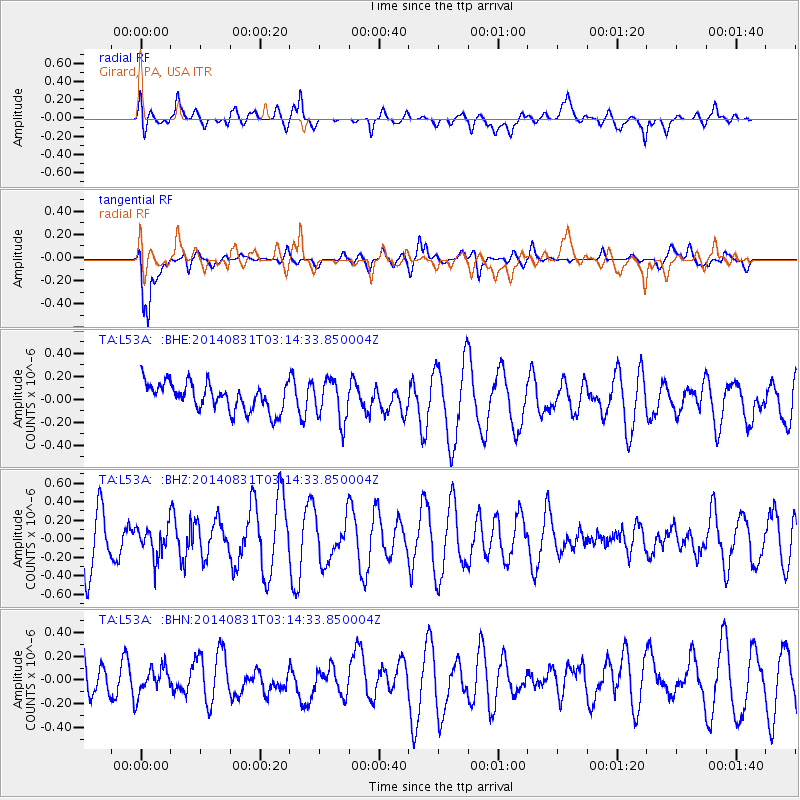
L53A Girard, PA, USA - Earthquake Result Viewer
*The percent match for this event was below the threshold and hence no stack was calculated.
| Earthquake location: |
Northern Alaska |
| Earthquake latitude/longitude: |
65.2/-149.0 |
| Earthquake time(UTC): |
2014/08/31 (243) 03:06:57 GMT |
| Earthquake Depth: |
16 km |
| Earthquake Magnitude: |
5.1 Mww, 5.1 ML, 4.9 mb, 4.8 Ms_20, 5.0 Mwr |
| Earthquake Catalog/Contributor: |
ISC/ISC |
|
| Network: |
TA USArray Transportable Network (new EarthScope stations) |
| Station: |
L53A Girard, PA, USA |
| Lat/Lon: |
41.95 N/80.26 W |
| Elevation: |
355 m |
|
| Distance: |
44.1 deg |
| Az: |
86.979 deg |
| Baz: |
325.548 deg |
| Ray Param: |
$rayparam |
*The percent match for this event was below the threshold and hence was not used in the summary stack. |
|
| Radial Match: |
66.471954 % |
| Radial Bump: |
400 |
| Transverse Match: |
77.89703 % |
| Transverse Bump: |
400 |
| SOD ConfigId: |
3390531 |
| Insert Time: |
2019-04-13 17:56:24.831 +0000 |
| GWidth: |
2.5 |
| Max Bumps: |
400 |
| Tol: |
0.001 |
|
Signal To Noise
| Channel | StoN | STA | LTA |
| TA:L53A: :BHZ:20140831T03:14:33.850004Z | 0.77090216 | 1.6712764E-7 | 2.1679487E-7 |
| TA:L53A: :BHN:20140831T03:14:33.850004Z | 0.7710067 | 1.18076194E-7 | 1.5314548E-7 |
| TA:L53A: :BHE:20140831T03:14:33.850004Z | 1.5097573 | 1.7902637E-7 | 1.1857957E-7 |
| Arrivals |
| Ps | |
| PpPs | |
| PsPs/PpSs | |


