You are here: Home > Network List > IU - Global Seismograph Network (GSN - IRIS/USGS) Stations List
> Station HNR Honiara, Solomon Islands > Earthquake Result Viewer
HNR Honiara, Solomon Islands - Earthquake Result Viewer
*The percent match for this event was below the threshold and hence no stack was calculated.
| Earthquake location: |
Timor Region |
| Earthquake latitude/longitude: |
-8.5/127.5 |
| Earthquake time(UTC): |
2013/02/23 (054) 11:09:19 GMT |
| Earthquake Depth: |
20 km |
| Earthquake Magnitude: |
5.7 MB, 5.7 MS, 5.9 MW, 5.6 MW |
| Earthquake Catalog/Contributor: |
WHDF/NEIC |
|
| Network: |
IU Global Seismograph Network (GSN - IRIS/USGS) |
| Station: |
HNR Honiara, Solomon Islands |
| Lat/Lon: |
9.44 S/159.95 E |
| Elevation: |
100 m |
|
| Distance: |
32.1 deg |
| Az: |
94.256 deg |
| Baz: |
269.098 deg |
| Ray Param: |
$rayparam |
*The percent match for this event was below the threshold and hence was not used in the summary stack. |
|
| Radial Match: |
52.98715 % |
| Radial Bump: |
400 |
| Transverse Match: |
52.4222 % |
| Transverse Bump: |
400 |
| SOD ConfigId: |
558545 |
| Insert Time: |
2013-09-18 08:04:44.723 +0000 |
| GWidth: |
2.5 |
| Max Bumps: |
400 |
| Tol: |
0.001 |
|
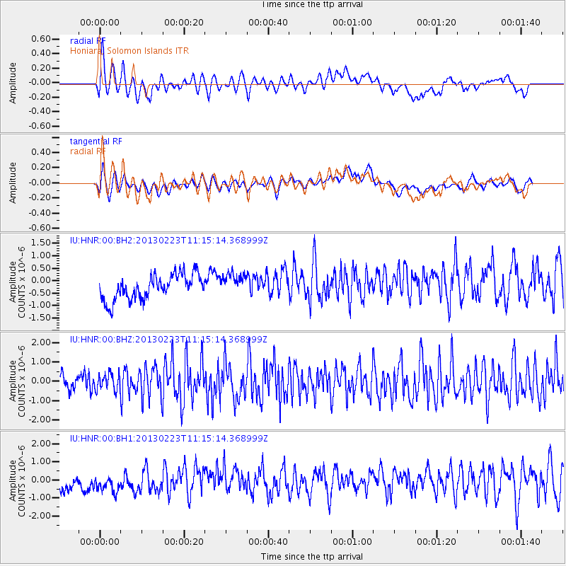
Signal To Noise
| Channel | StoN | STA | LTA |
| IU:HNR:00:BHZ:20130223T11:15:14.368999Z | 1.1653354 | 4.2085512E-7 | 3.6114506E-7 |
| IU:HNR:00:BH1:20130223T11:15:14.368999Z | 1.3015642 | 7.6628015E-7 | 5.887379E-7 |
| IU:HNR:00:BH2:20130223T11:15:14.368999Z | 0.91500556 | 4.5461385E-7 | 4.9684274E-7 |
| Arrivals |
| Ps | |
| PpPs | |
| PsPs/PpSs | |


