You are here: Home > Network List > IU - Global Seismograph Network (GSN - IRIS/USGS) Stations List
> Station POHA Pohakuloa, Hawaii, USA > Earthquake Result Viewer
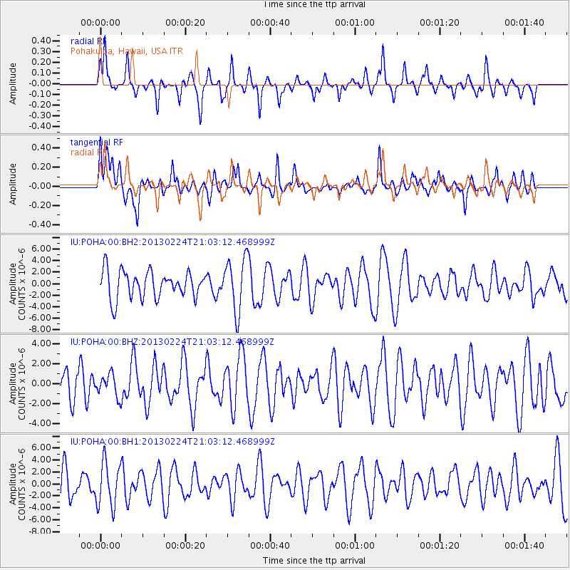
POHA Pohakuloa, Hawaii, USA - Earthquake Result Viewer
*The percent match for this event was below the threshold and hence no stack was calculated.
| Earthquake location: |
South Of Kermadec Islands |
| Earthquake latitude/longitude: |
-32.3/-178.1 |
| Earthquake time(UTC): |
2013/02/24 (055) 20:54:04 GMT |
| Earthquake Depth: |
10 km |
| Earthquake Magnitude: |
5.7 MW, 5.5 MS, 5.5 MW |
| Earthquake Catalog/Contributor: |
NEIC PDE/NEIC PDE-W |
|
| Network: |
IU Global Seismograph Network (GSN - IRIS/USGS) |
| Station: |
POHA Pohakuloa, Hawaii, USA |
| Lat/Lon: |
19.76 N/155.53 W |
| Elevation: |
1990 m |
|
| Distance: |
56.1 deg |
| Az: |
25.756 deg |
| Baz: |
202.989 deg |
| Ray Param: |
$rayparam |
*The percent match for this event was below the threshold and hence was not used in the summary stack. |
|
| Radial Match: |
52.201607 % |
| Radial Bump: |
276 |
| Transverse Match: |
45.05656 % |
| Transverse Bump: |
400 |
| SOD ConfigId: |
558545 |
| Insert Time: |
2013-09-18 08:08:50.722 +0000 |
| GWidth: |
2.5 |
| Max Bumps: |
400 |
| Tol: |
0.001 |
|
Signal To Noise
| Channel | StoN | STA | LTA |
| IU:POHA:00:BHZ:20130224T21:03:12.468999Z | 0.54431397 | 1.1525974E-6 | 2.117523E-6 |
| IU:POHA:00:BH1:20130224T21:03:12.468999Z | 1.3015369 | 3.7556856E-6 | 2.8855775E-6 |
| IU:POHA:00:BH2:20130224T21:03:12.468999Z | 2.0130239 | 4.7188037E-6 | 2.3441369E-6 |
| Arrivals |
| Ps | |
| PpPs | |
| PsPs/PpSs | |


