You are here: Home > Network List > US - United States National Seismic Network Stations List
> Station HAWA Hanford, Washington, USA > Earthquake Result Viewer
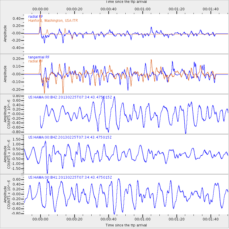
HAWA Hanford, Washington, USA - Earthquake Result Viewer
*The percent match for this event was below the threshold and hence no stack was calculated.
| Earthquake location: |
Eastern Honshu, Japan |
| Earthquake latitude/longitude: |
36.8/139.2 |
| Earthquake time(UTC): |
2013/02/25 (056) 07:23:55 GMT |
| Earthquake Depth: |
10 km |
| Earthquake Magnitude: |
5.9 MB, 5.6 MS, 5.8 MW, 5.7 MW |
| Earthquake Catalog/Contributor: |
WHDF/NEIC |
|
| Network: |
US United States National Seismic Network |
| Station: |
HAWA Hanford, Washington, USA |
| Lat/Lon: |
46.39 N/119.53 W |
| Elevation: |
364 m |
|
| Distance: |
71.2 deg |
| Az: |
45.834 deg |
| Baz: |
303.758 deg |
| Ray Param: |
$rayparam |
*The percent match for this event was below the threshold and hence was not used in the summary stack. |
|
| Radial Match: |
63.53762 % |
| Radial Bump: |
400 |
| Transverse Match: |
52.778973 % |
| Transverse Bump: |
363 |
| SOD ConfigId: |
558545 |
| Insert Time: |
2013-09-18 08:16:30.721 +0000 |
| GWidth: |
2.5 |
| Max Bumps: |
400 |
| Tol: |
0.001 |
|
Signal To Noise
| Channel | StoN | STA | LTA |
| US:HAWA:00:BHZ:20130225T07:34:43.475015Z | 2.0374331 | 9.722941E-7 | 4.7721517E-7 |
| US:HAWA:00:BH1:20130225T07:34:43.475015Z | 1.450169 | 4.402157E-7 | 3.0356165E-7 |
| US:HAWA:00:BH2:20130225T07:34:43.475015Z | 1.5851206 | 3.757508E-7 | 2.3704872E-7 |
| Arrivals |
| Ps | |
| PpPs | |
| PsPs/PpSs | |


