You are here: Home > Network List > US - United States National Seismic Network Stations List
> Station LAO LASA Array, Montana, USA > Earthquake Result Viewer
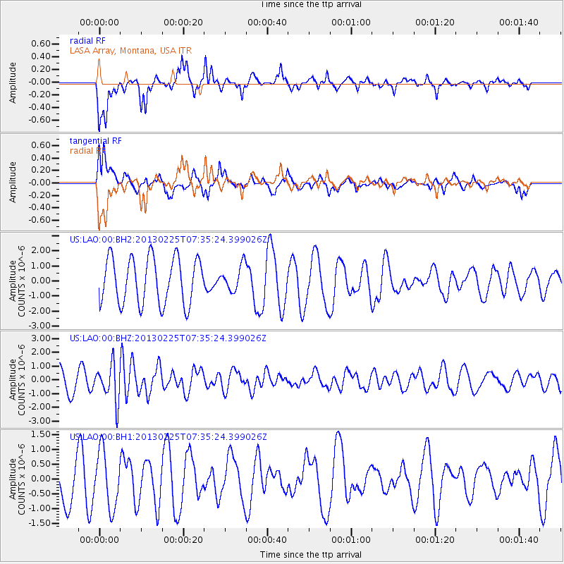
LAO LASA Array, Montana, USA - Earthquake Result Viewer
*The percent match for this event was below the threshold and hence no stack was calculated.
| Earthquake location: |
Eastern Honshu, Japan |
| Earthquake latitude/longitude: |
36.8/139.2 |
| Earthquake time(UTC): |
2013/02/25 (056) 07:23:55 GMT |
| Earthquake Depth: |
10 km |
| Earthquake Magnitude: |
5.9 MB, 5.6 MS, 5.8 MW, 5.7 MW |
| Earthquake Catalog/Contributor: |
WHDF/NEIC |
|
| Network: |
US United States National Seismic Network |
| Station: |
LAO LASA Array, Montana, USA |
| Lat/Lon: |
46.69 N/106.22 W |
| Elevation: |
902 m |
|
| Distance: |
78.2 deg |
| Az: |
39.768 deg |
| Baz: |
311.804 deg |
| Ray Param: |
$rayparam |
*The percent match for this event was below the threshold and hence was not used in the summary stack. |
|
| Radial Match: |
80.46409 % |
| Radial Bump: |
400 |
| Transverse Match: |
58.61628 % |
| Transverse Bump: |
400 |
| SOD ConfigId: |
558545 |
| Insert Time: |
2013-09-18 08:16:51.694 +0000 |
| GWidth: |
2.5 |
| Max Bumps: |
400 |
| Tol: |
0.001 |
|
Signal To Noise
| Channel | StoN | STA | LTA |
| US:LAO:00:BHZ:20130225T07:35:24.399026Z | 2.0458374 | 1.353719E-6 | 6.616943E-7 |
| US:LAO:00:BH1:20130225T07:35:24.399026Z | 1.3573534 | 9.840401E-7 | 7.249697E-7 |
| US:LAO:00:BH2:20130225T07:35:24.399026Z | 0.5608571 | 8.592515E-7 | 1.5320327E-6 |
| Arrivals |
| Ps | |
| PpPs | |
| PsPs/PpSs | |


