You are here: Home > Network List > US - United States National Seismic Network Stations List
> Station AMTX Amarillo, Texas, USA > Earthquake Result Viewer
AMTX Amarillo, Texas, USA - Earthquake Result Viewer
*The percent match for this event was below the threshold and hence no stack was calculated.
| Earthquake location: |
Kuril Islands |
| Earthquake latitude/longitude: |
51.0/157.3 |
| Earthquake time(UTC): |
2013/02/28 (059) 14:05:50 GMT |
| Earthquake Depth: |
41 km |
| Earthquake Magnitude: |
6.4 MB, 6.7 MS, 6.9 MW, 6.8 MW |
| Earthquake Catalog/Contributor: |
WHDF/NEIC |
|
| Network: |
US United States National Seismic Network |
| Station: |
AMTX Amarillo, Texas, USA |
| Lat/Lon: |
34.53 N/101.41 W |
| Elevation: |
1010 m |
|
| Distance: |
70.4 deg |
| Az: |
59.216 deg |
| Baz: |
318.84 deg |
| Ray Param: |
$rayparam |
*The percent match for this event was below the threshold and hence was not used in the summary stack. |
|
| Radial Match: |
92.88711 % |
| Radial Bump: |
400 |
| Transverse Match: |
72.52525 % |
| Transverse Bump: |
400 |
| SOD ConfigId: |
558545 |
| Insert Time: |
2013-09-18 08:35:13.252 +0000 |
| GWidth: |
2.5 |
| Max Bumps: |
400 |
| Tol: |
0.001 |
|
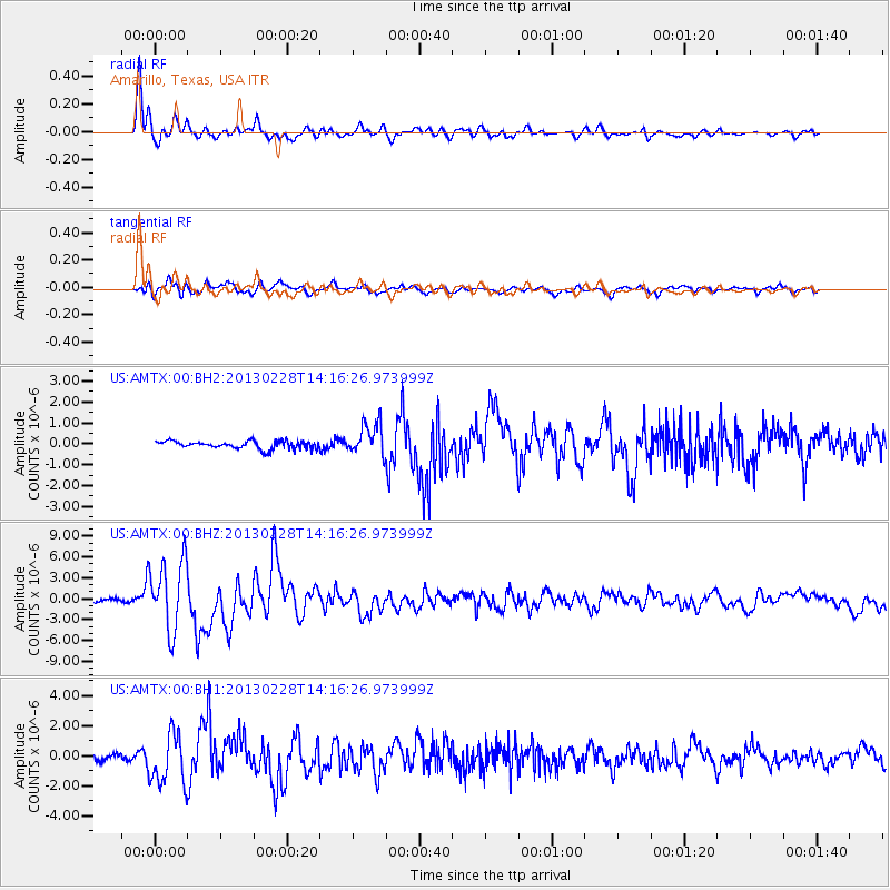
Signal To Noise
| Channel | StoN | STA | LTA |
| US:AMTX:00:BHZ:20130228T14:16:26.973999Z | 22.603342 | 4.976786E-6 | 2.2017922E-7 |
| US:AMTX:00:BH1:20130228T14:16:26.973999Z | 10.022913 | 1.73629E-6 | 1.7323208E-7 |
| US:AMTX:00:BH2:20130228T14:16:26.973999Z | 6.4829216 | 1.2431007E-6 | 1.9175006E-7 |
| Arrivals |
| Ps | |
| PpPs | |
| PsPs/PpSs | |


