You are here: Home > Network List > US - United States National Seismic Network Stations List
> Station DGMT Dagmar, Montana, USA > Earthquake Result Viewer
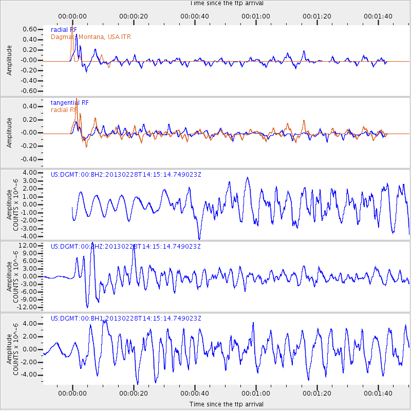
DGMT Dagmar, Montana, USA - Earthquake Result Viewer
*The percent match for this event was below the threshold and hence no stack was calculated.
| Earthquake location: |
Kuril Islands |
| Earthquake latitude/longitude: |
51.0/157.3 |
| Earthquake time(UTC): |
2013/02/28 (059) 14:05:50 GMT |
| Earthquake Depth: |
41 km |
| Earthquake Magnitude: |
6.4 MB, 6.7 MS, 6.9 MW, 6.8 MW |
| Earthquake Catalog/Contributor: |
WHDF/NEIC |
|
| Network: |
US United States National Seismic Network |
| Station: |
DGMT Dagmar, Montana, USA |
| Lat/Lon: |
48.47 N/104.20 W |
| Elevation: |
0.0 m |
|
| Distance: |
59.0 deg |
| Az: |
50.194 deg |
| Baz: |
313.104 deg |
| Ray Param: |
$rayparam |
*The percent match for this event was below the threshold and hence was not used in the summary stack. |
|
| Radial Match: |
86.72356 % |
| Radial Bump: |
400 |
| Transverse Match: |
77.300064 % |
| Transverse Bump: |
400 |
| SOD ConfigId: |
558545 |
| Insert Time: |
2013-09-18 08:35:44.357 +0000 |
| GWidth: |
2.5 |
| Max Bumps: |
400 |
| Tol: |
0.001 |
|
Signal To Noise
| Channel | StoN | STA | LTA |
| US:DGMT:00:BHZ:20130228T14:15:14.749023Z | 22.802158 | 4.8665415E-6 | 2.134246E-7 |
| US:DGMT:00:BH1:20130228T14:15:14.749023Z | 3.3775635 | 1.446471E-6 | 4.2825872E-7 |
| US:DGMT:00:BH2:20130228T14:15:14.749023Z | 1.08813 | 1.0602265E-6 | 9.743566E-7 |
| Arrivals |
| Ps | |
| PpPs | |
| PsPs/PpSs | |


