You are here: Home > Network List > TA - USArray Transportable Network (new EarthScope stations) Stations List
> Station G59A Clarenceville, QC, USA > Earthquake Result Viewer
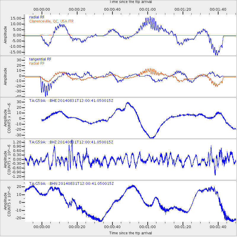
G59A Clarenceville, QC, USA - Earthquake Result Viewer
*The percent match for this event was below the threshold and hence no stack was calculated.
| Earthquake location: |
Hindu Kush Region, Afghanistan |
| Earthquake latitude/longitude: |
36.6/71.0 |
| Earthquake time(UTC): |
2014/08/31 (243) 11:48:24 GMT |
| Earthquake Depth: |
200 km |
| Earthquake Magnitude: |
5.3 MW, 5.2 mb |
| Earthquake Catalog/Contributor: |
ISC/ISC |
|
| Network: |
TA USArray Transportable Network (new EarthScope stations) |
| Station: |
G59A Clarenceville, QC, USA |
| Lat/Lon: |
45.08 N/73.18 W |
| Elevation: |
36 m |
|
| Distance: |
92.5 deg |
| Az: |
335.456 deg |
| Baz: |
28.168 deg |
| Ray Param: |
$rayparam |
*The percent match for this event was below the threshold and hence was not used in the summary stack. |
|
| Radial Match: |
56.195442 % |
| Radial Bump: |
400 |
| Transverse Match: |
76.95156 % |
| Transverse Bump: |
400 |
| SOD ConfigId: |
3390531 |
| Insert Time: |
2019-04-13 18:03:07.347 +0000 |
| GWidth: |
2.5 |
| Max Bumps: |
400 |
| Tol: |
0.001 |
|
Signal To Noise
| Channel | StoN | STA | LTA |
| TA:G59A: :BHZ:20140831T12:00:41.050015Z | 1.0077345 | 2.8068513E-7 | 2.7853082E-7 |
| TA:G59A: :BHN:20140831T12:00:41.050015Z | 1.2083124 | 3.2009775E-5 | 2.6491309E-5 |
| TA:G59A: :BHE:20140831T12:00:41.050015Z | 1.6114848 | 8.714943E-6 | 5.4080206E-6 |
| Arrivals |
| Ps | |
| PpPs | |
| PsPs/PpSs | |


