You are here: Home > Network List > US - United States National Seismic Network Stations List
> Station LKWY Lake (Yellowstone--Lake), Wyoming, USA > Earthquake Result Viewer
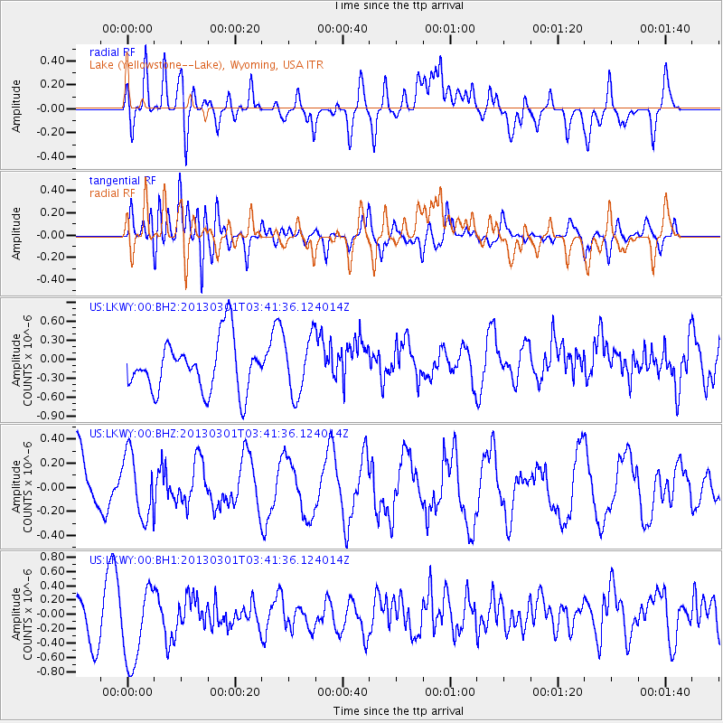
LKWY Lake (Yellowstone--Lake), Wyoming, USA - Earthquake Result Viewer
*The percent match for this event was below the threshold and hence no stack was calculated.
| Earthquake location: |
Mariana Islands Region |
| Earthquake latitude/longitude: |
21.8/144.0 |
| Earthquake time(UTC): |
2013/03/01 (060) 03:29:46 GMT |
| Earthquake Depth: |
153 km |
| Earthquake Magnitude: |
5.5 MW, 5.4 MW, 5.3 MB |
| Earthquake Catalog/Contributor: |
WHDF/NEIC |
|
| Network: |
US United States National Seismic Network |
| Station: |
LKWY Lake (Yellowstone--Lake), Wyoming, USA |
| Lat/Lon: |
44.57 N/110.40 W |
| Elevation: |
2424 m |
|
| Distance: |
85.5 deg |
| Az: |
43.674 deg |
| Baz: |
296.096 deg |
| Ray Param: |
$rayparam |
*The percent match for this event was below the threshold and hence was not used in the summary stack. |
|
| Radial Match: |
51.06045 % |
| Radial Bump: |
400 |
| Transverse Match: |
56.105656 % |
| Transverse Bump: |
400 |
| SOD ConfigId: |
558545 |
| Insert Time: |
2013-09-18 08:42:25.890 +0000 |
| GWidth: |
2.5 |
| Max Bumps: |
400 |
| Tol: |
0.001 |
|
Signal To Noise
| Channel | StoN | STA | LTA |
| US:LKWY:00:BHZ:20130301T03:41:36.124014Z | 0.94281495 | 2.669862E-7 | 2.8317987E-7 |
| US:LKWY:00:BH1:20130301T03:41:36.124014Z | 2.459493 | 5.6649964E-7 | 2.3033188E-7 |
| US:LKWY:00:BH2:20130301T03:41:36.124014Z | 1.113498 | 4.5467883E-7 | 4.0833376E-7 |
| Arrivals |
| Ps | |
| PpPs | |
| PsPs/PpSs | |


