You are here: Home > Network List > US - United States National Seismic Network Stations List
> Station ACSO Alum Creek State Park, Ohio, USA > Earthquake Result Viewer
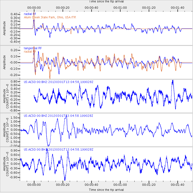
ACSO Alum Creek State Park, Ohio, USA - Earthquake Result Viewer
*The percent match for this event was below the threshold and hence no stack was calculated.
| Earthquake location: |
Kuril Islands |
| Earthquake latitude/longitude: |
50.9/157.5 |
| Earthquake time(UTC): |
2013/03/01 (060) 12:53:51 GMT |
| Earthquake Depth: |
33 km |
| Earthquake Magnitude: |
5.7 MB, 5.8 MS, 6.4 MW, 6.4 MW |
| Earthquake Catalog/Contributor: |
WHDF/NEIC |
|
| Network: |
US United States National Seismic Network |
| Station: |
ACSO Alum Creek State Park, Ohio, USA |
| Lat/Lon: |
40.23 N/82.98 W |
| Elevation: |
288 m |
|
| Distance: |
75.0 deg |
| Az: |
43.579 deg |
| Baz: |
325.233 deg |
| Ray Param: |
$rayparam |
*The percent match for this event was below the threshold and hence was not used in the summary stack. |
|
| Radial Match: |
64.3221 % |
| Radial Bump: |
400 |
| Transverse Match: |
59.117096 % |
| Transverse Bump: |
400 |
| SOD ConfigId: |
558545 |
| Insert Time: |
2013-09-18 08:46:09.937 +0000 |
| GWidth: |
2.5 |
| Max Bumps: |
400 |
| Tol: |
0.001 |
|
Signal To Noise
| Channel | StoN | STA | LTA |
| US:ACSO:00:BHZ:20130301T13:04:58.199028Z | 4.2007194 | 7.228679E-7 | 1.7208195E-7 |
| US:ACSO:00:BH1:20130301T13:04:58.199028Z | 1.313394 | 3.0367946E-7 | 2.3121733E-7 |
| US:ACSO:00:BH2:20130301T13:04:58.199028Z | 1.4468089 | 2.8351494E-7 | 1.959588E-7 |
| Arrivals |
| Ps | |
| PpPs | |
| PsPs/PpSs | |


