You are here: Home > Network List > US - United States National Seismic Network Stations List
> Station DGMT Dagmar, Montana, USA > Earthquake Result Viewer
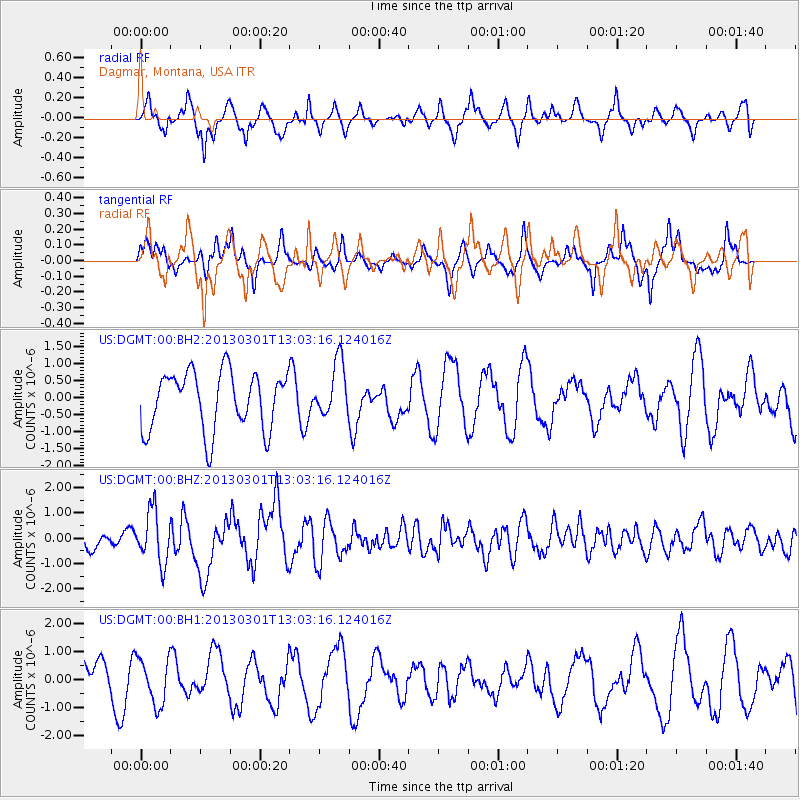
DGMT Dagmar, Montana, USA - Earthquake Result Viewer
*The percent match for this event was below the threshold and hence no stack was calculated.
| Earthquake location: |
Kuril Islands |
| Earthquake latitude/longitude: |
50.9/157.5 |
| Earthquake time(UTC): |
2013/03/01 (060) 12:53:51 GMT |
| Earthquake Depth: |
33 km |
| Earthquake Magnitude: |
5.7 MB, 5.8 MS, 6.4 MW, 6.4 MW |
| Earthquake Catalog/Contributor: |
WHDF/NEIC |
|
| Network: |
US United States National Seismic Network |
| Station: |
DGMT Dagmar, Montana, USA |
| Lat/Lon: |
48.47 N/104.20 W |
| Elevation: |
0.0 m |
|
| Distance: |
58.9 deg |
| Az: |
50.257 deg |
| Baz: |
312.971 deg |
| Ray Param: |
$rayparam |
*The percent match for this event was below the threshold and hence was not used in the summary stack. |
|
| Radial Match: |
67.61491 % |
| Radial Bump: |
382 |
| Transverse Match: |
58.983265 % |
| Transverse Bump: |
343 |
| SOD ConfigId: |
558545 |
| Insert Time: |
2013-09-18 08:46:41.357 +0000 |
| GWidth: |
2.5 |
| Max Bumps: |
400 |
| Tol: |
0.001 |
|
Signal To Noise
| Channel | StoN | STA | LTA |
| US:DGMT:00:BHZ:20130301T13:03:16.124016Z | 2.8112957 | 1.0246617E-6 | 3.6448026E-7 |
| US:DGMT:00:BH1:20130301T13:03:16.124016Z | 1.0827161 | 8.1987235E-7 | 7.572367E-7 |
| US:DGMT:00:BH2:20130301T13:03:16.124016Z | 0.93461776 | 7.9647583E-7 | 8.521942E-7 |
| Arrivals |
| Ps | |
| PpPs | |
| PsPs/PpSs | |


