You are here: Home > Network List > US - United States National Seismic Network Stations List
> Station HAWA Hanford, Washington, USA > Earthquake Result Viewer
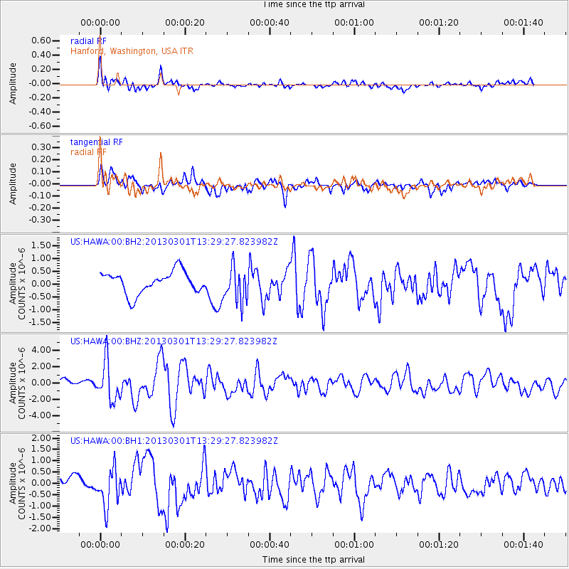
HAWA Hanford, Washington, USA - Earthquake Result Viewer
*The percent match for this event was below the threshold and hence no stack was calculated.
| Earthquake location: |
Kuril Islands |
| Earthquake latitude/longitude: |
51.0/157.4 |
| Earthquake time(UTC): |
2013/03/01 (060) 13:20:49 GMT |
| Earthquake Depth: |
29 km |
| Earthquake Magnitude: |
6.3 MB, 6.3 MS, 6.5 MW, 6.4 MW |
| Earthquake Catalog/Contributor: |
WHDF/NEIC |
|
| Network: |
US United States National Seismic Network |
| Station: |
HAWA Hanford, Washington, USA |
| Lat/Lon: |
46.39 N/119.53 W |
| Elevation: |
364 m |
|
| Distance: |
52.3 deg |
| Az: |
60.313 deg |
| Baz: |
307.457 deg |
| Ray Param: |
$rayparam |
*The percent match for this event was below the threshold and hence was not used in the summary stack. |
|
| Radial Match: |
71.00664 % |
| Radial Bump: |
400 |
| Transverse Match: |
71.47183 % |
| Transverse Bump: |
400 |
| SOD ConfigId: |
558545 |
| Insert Time: |
2013-09-18 08:53:02.972 +0000 |
| GWidth: |
2.5 |
| Max Bumps: |
400 |
| Tol: |
0.001 |
|
Signal To Noise
| Channel | StoN | STA | LTA |
| US:HAWA:00:BHZ:20130301T13:29:27.823982Z | 5.221707 | 2.4377202E-6 | 4.6684357E-7 |
| US:HAWA:00:BH1:20130301T13:29:27.823982Z | 2.718444 | 8.5516626E-7 | 3.145793E-7 |
| US:HAWA:00:BH2:20130301T13:29:27.823982Z | 1.595387 | 6.7783736E-7 | 4.2487332E-7 |
| Arrivals |
| Ps | |
| PpPs | |
| PsPs/PpSs | |


