You are here: Home > Network List > US - United States National Seismic Network Stations List
> Station WMOK Wichita Mountains, Oklahoma, USA > Earthquake Result Viewer
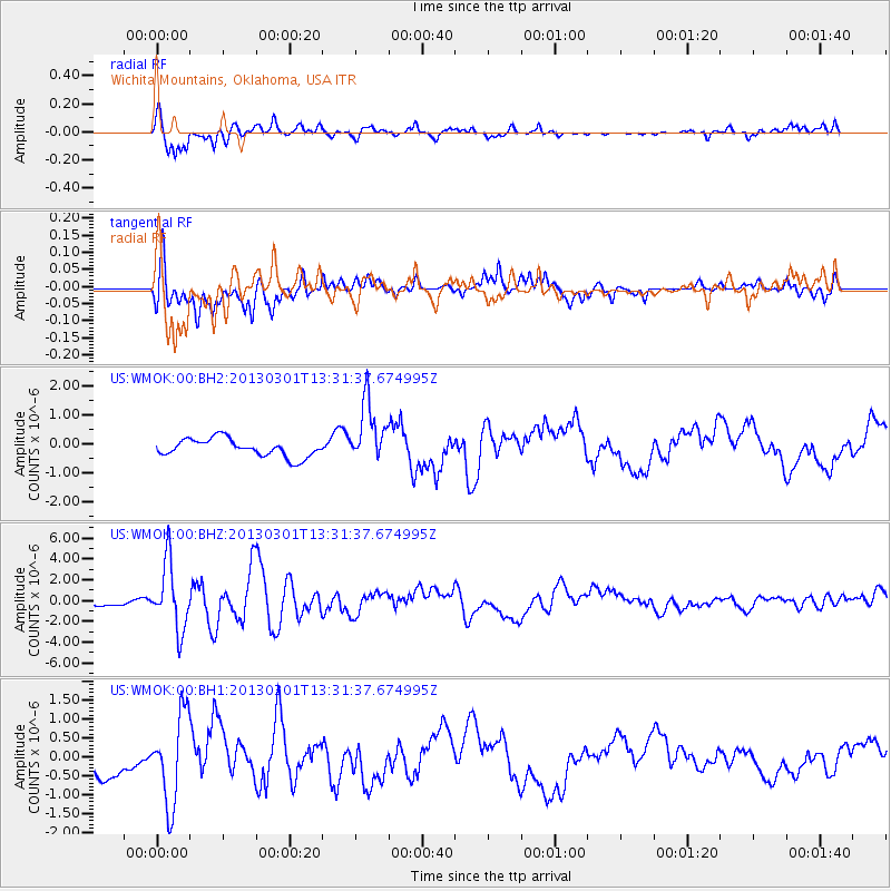
WMOK Wichita Mountains, Oklahoma, USA - Earthquake Result Viewer
*The percent match for this event was below the threshold and hence no stack was calculated.
| Earthquake location: |
Kuril Islands |
| Earthquake latitude/longitude: |
51.0/157.4 |
| Earthquake time(UTC): |
2013/03/01 (060) 13:20:49 GMT |
| Earthquake Depth: |
29 km |
| Earthquake Magnitude: |
6.3 MB, 6.3 MS, 6.5 MW, 6.4 MW |
| Earthquake Catalog/Contributor: |
WHDF/NEIC |
|
| Network: |
US United States National Seismic Network |
| Station: |
WMOK Wichita Mountains, Oklahoma, USA |
| Lat/Lon: |
34.74 N/98.78 W |
| Elevation: |
486 m |
|
| Distance: |
71.6 deg |
| Az: |
57.422 deg |
| Baz: |
319.676 deg |
| Ray Param: |
$rayparam |
*The percent match for this event was below the threshold and hence was not used in the summary stack. |
|
| Radial Match: |
70.88775 % |
| Radial Bump: |
400 |
| Transverse Match: |
48.905228 % |
| Transverse Bump: |
400 |
| SOD ConfigId: |
558545 |
| Insert Time: |
2013-09-18 08:54:32.967 +0000 |
| GWidth: |
2.5 |
| Max Bumps: |
400 |
| Tol: |
0.001 |
|
Signal To Noise
| Channel | StoN | STA | LTA |
| US:WMOK:00:BHZ:20130301T13:31:37.674995Z | 10.214335 | 3.1530735E-6 | 3.08691E-7 |
| US:WMOK:00:BH1:20130301T13:31:37.674995Z | 2.7357528 | 1.1739455E-6 | 4.2911242E-7 |
| US:WMOK:00:BH2:20130301T13:31:37.674995Z | 3.4941137 | 1.06577E-6 | 3.0501872E-7 |
| Arrivals |
| Ps | |
| PpPs | |
| PsPs/PpSs | |


