You are here: Home > Network List > US - United States National Seismic Network Stations List
> Station EGMT Eagleton, Montana, USA > Earthquake Result Viewer
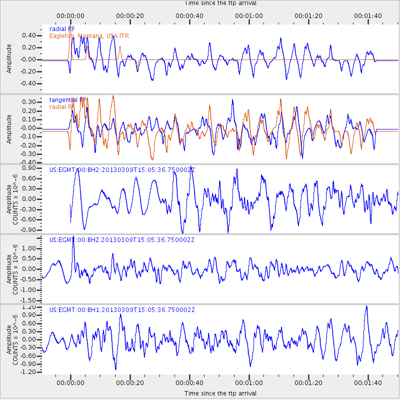
EGMT Eagleton, Montana, USA - Earthquake Result Viewer
*The percent match for this event was below the threshold and hence no stack was calculated.
| Earthquake location: |
Kuril Islands |
| Earthquake latitude/longitude: |
50.9/157.2 |
| Earthquake time(UTC): |
2013/03/09 (068) 14:56:28 GMT |
| Earthquake Depth: |
39 km |
| Earthquake Magnitude: |
5.7 MB, 5.3 MS, 5.8 MW, 5.9 MW |
| Earthquake Catalog/Contributor: |
WHDF/NEIC |
|
| Network: |
US United States National Seismic Network |
| Station: |
EGMT Eagleton, Montana, USA |
| Lat/Lon: |
48.02 N/109.75 W |
| Elevation: |
1055 m |
|
| Distance: |
56.6 deg |
| Az: |
53.455 deg |
| Baz: |
310.716 deg |
| Ray Param: |
$rayparam |
*The percent match for this event was below the threshold and hence was not used in the summary stack. |
|
| Radial Match: |
54.004005 % |
| Radial Bump: |
400 |
| Transverse Match: |
53.665695 % |
| Transverse Bump: |
400 |
| SOD ConfigId: |
558545 |
| Insert Time: |
2013-09-18 09:10:38.630 +0000 |
| GWidth: |
2.5 |
| Max Bumps: |
400 |
| Tol: |
0.001 |
|
Signal To Noise
| Channel | StoN | STA | LTA |
| US:EGMT:00:BHZ:20130309T15:05:36.750002Z | 2.6956863 | 5.4612565E-7 | 2.0259245E-7 |
| US:EGMT:00:BH1:20130309T15:05:36.750002Z | 0.5858148 | 2.2334781E-7 | 3.8126015E-7 |
| US:EGMT:00:BH2:20130309T15:05:36.750002Z | 0.7556698 | 2.8483694E-7 | 3.769331E-7 |
| Arrivals |
| Ps | |
| PpPs | |
| PsPs/PpSs | |


