You are here: Home > Network List > US - United States National Seismic Network Stations List
> Station DGMT Dagmar, Montana, USA > Earthquake Result Viewer
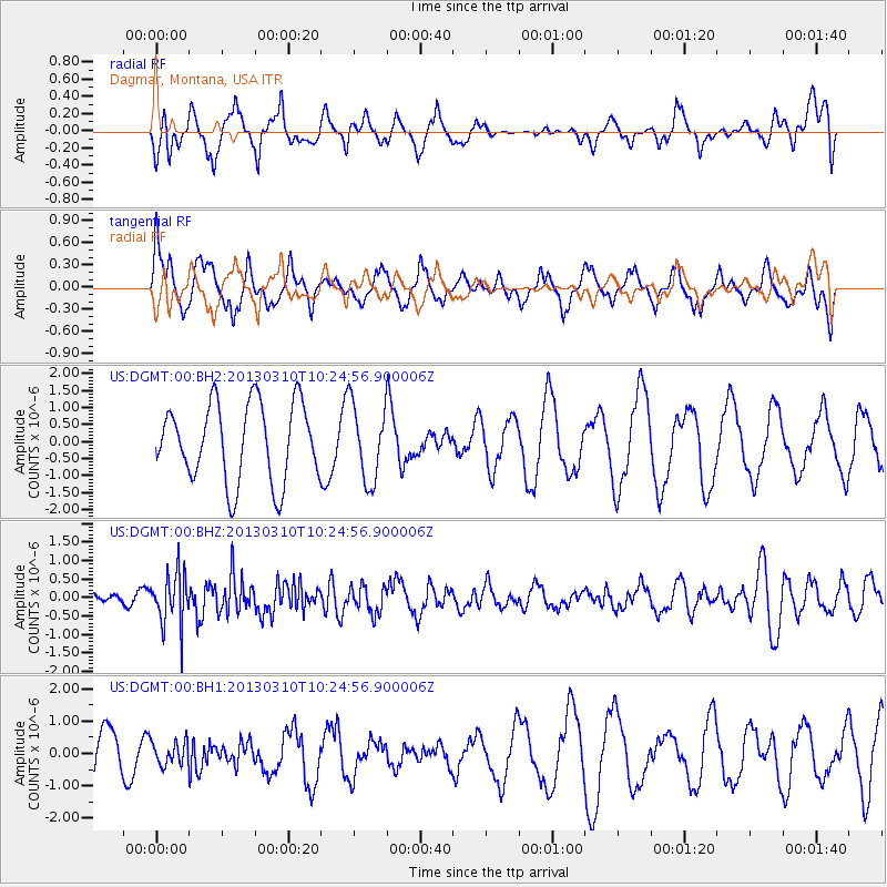
DGMT Dagmar, Montana, USA - Earthquake Result Viewer
*The percent match for this event was below the threshold and hence no stack was calculated.
| Earthquake location: |
Off Coast Of Central America |
| Earthquake latitude/longitude: |
12.8/-90.6 |
| Earthquake time(UTC): |
2013/03/10 (069) 10:18:15 GMT |
| Earthquake Depth: |
8.0 km |
| Earthquake Magnitude: |
5.5 MW, 5.5 MW, 5.7 MB |
| Earthquake Catalog/Contributor: |
NEIC PDE/NEIC PDE-W |
|
| Network: |
US United States National Seismic Network |
| Station: |
DGMT Dagmar, Montana, USA |
| Lat/Lon: |
48.47 N/104.20 W |
| Elevation: |
0.0 m |
|
| Distance: |
37.3 deg |
| Az: |
345.083 deg |
| Baz: |
157.833 deg |
| Ray Param: |
$rayparam |
*The percent match for this event was below the threshold and hence was not used in the summary stack. |
|
| Radial Match: |
57.771885 % |
| Radial Bump: |
387 |
| Transverse Match: |
45.66927 % |
| Transverse Bump: |
396 |
| SOD ConfigId: |
558545 |
| Insert Time: |
2013-09-18 09:14:39.633 +0000 |
| GWidth: |
2.5 |
| Max Bumps: |
400 |
| Tol: |
0.001 |
|
Signal To Noise
| Channel | StoN | STA | LTA |
| US:DGMT:00:BHZ:20130310T10:24:56.900006Z | 2.5658958 | 7.0974335E-7 | 2.7660647E-7 |
| US:DGMT:00:BH1:20130310T10:24:56.900006Z | 0.54559666 | 3.6010198E-7 | 6.60015E-7 |
| US:DGMT:00:BH2:20130310T10:24:56.900006Z | 0.989001 | 1.1318442E-6 | 1.1444318E-6 |
| Arrivals |
| Ps | |
| PpPs | |
| PsPs/PpSs | |


