You are here: Home > Network List > US - United States National Seismic Network Stations List
> Station HAWA Hanford, Washington, USA > Earthquake Result Viewer
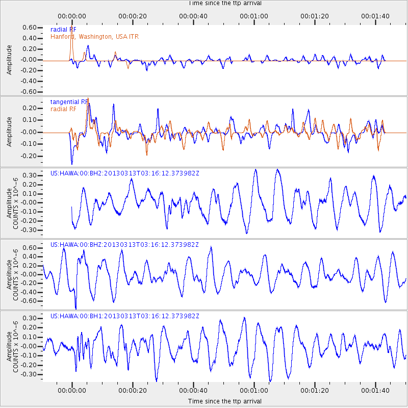
HAWA Hanford, Washington, USA - Earthquake Result Viewer
*The percent match for this event was below the threshold and hence no stack was calculated.
| Earthquake location: |
South Pacific Ocean |
| Earthquake latitude/longitude: |
-8.8/-131.9 |
| Earthquake time(UTC): |
2013/03/13 (072) 03:07:04 GMT |
| Earthquake Depth: |
10 km |
| Earthquake Magnitude: |
5.5 MB, 5.3 MS |
| Earthquake Catalog/Contributor: |
WHDF/NEIC |
|
| Network: |
US United States National Seismic Network |
| Station: |
HAWA Hanford, Washington, USA |
| Lat/Lon: |
46.39 N/119.53 W |
| Elevation: |
364 m |
|
| Distance: |
56.0 deg |
| Az: |
10.312 deg |
| Baz: |
194.811 deg |
| Ray Param: |
$rayparam |
*The percent match for this event was below the threshold and hence was not used in the summary stack. |
|
| Radial Match: |
62.23304 % |
| Radial Bump: |
400 |
| Transverse Match: |
61.299934 % |
| Transverse Bump: |
400 |
| SOD ConfigId: |
558545 |
| Insert Time: |
2013-09-18 09:24:32.671 +0000 |
| GWidth: |
2.5 |
| Max Bumps: |
400 |
| Tol: |
0.001 |
|
Signal To Noise
| Channel | StoN | STA | LTA |
| US:HAWA:00:BHZ:20130313T03:16:12.373982Z | 2.3594928 | 3.9891546E-7 | 1.6906831E-7 |
| US:HAWA:00:BH1:20130313T03:16:12.373982Z | 0.8832259 | 9.2660386E-8 | 1.0491131E-7 |
| US:HAWA:00:BH2:20130313T03:16:12.373982Z | 0.9063686 | 1.1174405E-7 | 1.2328765E-7 |
| Arrivals |
| Ps | |
| PpPs | |
| PsPs/PpSs | |


