You are here: Home > Network List > US - United States National Seismic Network Stations List
> Station EGMT Eagleton, Montana, USA > Earthquake Result Viewer
EGMT Eagleton, Montana, USA - Earthquake Result Viewer
*The percent match for this event was below the threshold and hence no stack was calculated.
| Earthquake location: |
East Of Kuril Islands |
| Earthquake latitude/longitude: |
50.7/160.2 |
| Earthquake time(UTC): |
2013/03/24 (083) 04:18:33 GMT |
| Earthquake Depth: |
8.0 km |
| Earthquake Magnitude: |
6.1 MB, 5.5 MS, 5.9 MW, 6.1 MW |
| Earthquake Catalog/Contributor: |
WHDF/NEIC |
|
| Network: |
US United States National Seismic Network |
| Station: |
EGMT Eagleton, Montana, USA |
| Lat/Lon: |
48.02 N/109.75 W |
| Elevation: |
1055 m |
|
| Distance: |
55.1 deg |
| Az: |
54.899 deg |
| Baz: |
309.238 deg |
| Ray Param: |
$rayparam |
*The percent match for this event was below the threshold and hence was not used in the summary stack. |
|
| Radial Match: |
67.2 % |
| Radial Bump: |
324 |
| Transverse Match: |
55.769554 % |
| Transverse Bump: |
400 |
| SOD ConfigId: |
558545 |
| Insert Time: |
2013-09-18 09:45:35.635 +0000 |
| GWidth: |
2.5 |
| Max Bumps: |
400 |
| Tol: |
0.001 |
|
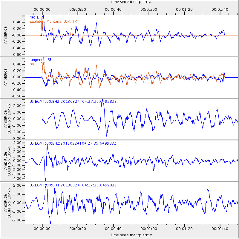
Signal To Noise
| Channel | StoN | STA | LTA |
| US:EGMT:00:BHZ:20130324T04:27:35.649983Z | 3.696539 | 1.8620813E-6 | 5.0373643E-7 |
| US:EGMT:00:BH1:20130324T04:27:35.649983Z | 2.248839 | 1.3330035E-6 | 5.9275186E-7 |
| US:EGMT:00:BH2:20130324T04:27:35.649983Z | 2.0574381 | 1.5270093E-6 | 7.421897E-7 |
| Arrivals |
| Ps | |
| PpPs | |
| PsPs/PpSs | |


