You are here: Home > Network List > NE - New England Seismic Network Stations List
> Station EMMW Machias, ME, USA > Earthquake Result Viewer
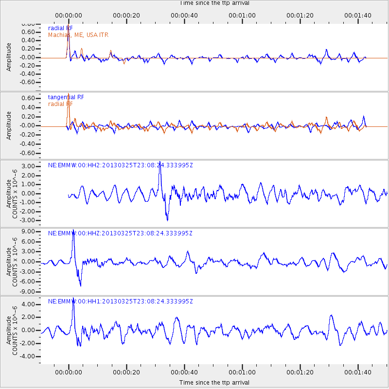
EMMW Machias, ME, USA - Earthquake Result Viewer
*The percent match for this event was below the threshold and hence no stack was calculated.
| Earthquake location: |
Guatemala |
| Earthquake latitude/longitude: |
14.5/-90.5 |
| Earthquake time(UTC): |
2013/03/25 (084) 23:02:12 GMT |
| Earthquake Depth: |
189 km |
| Earthquake Magnitude: |
6.2 MB, 6.2 MW, 6.2 MW |
| Earthquake Catalog/Contributor: |
WHDF/NEIC |
|
| Network: |
NE New England Seismic Network |
| Station: |
EMMW Machias, ME, USA |
| Lat/Lon: |
44.71 N/67.46 W |
| Elevation: |
35 m |
|
| Distance: |
35.9 deg |
| Az: |
28.376 deg |
| Baz: |
220.209 deg |
| Ray Param: |
$rayparam |
*The percent match for this event was below the threshold and hence was not used in the summary stack. |
|
| Radial Match: |
72.51816 % |
| Radial Bump: |
332 |
| Transverse Match: |
55.19668 % |
| Transverse Bump: |
374 |
| SOD ConfigId: |
558545 |
| Insert Time: |
2013-09-18 09:51:38.187 +0000 |
| GWidth: |
2.5 |
| Max Bumps: |
400 |
| Tol: |
0.001 |
|
Signal To Noise
| Channel | StoN | STA | LTA |
| NE:EMMW:00:HHZ:20130325T23:08:24.333995Z | 9.9913225 | 4.000949E-6 | 4.0044236E-7 |
| NE:EMMW:00:HH1:20130325T23:08:24.333995Z | 4.400973 | 1.8187734E-6 | 4.1326624E-7 |
| NE:EMMW:00:HH2:20130325T23:08:24.333995Z | 3.1860015 | 1.5909003E-6 | 4.9934073E-7 |
| Arrivals |
| Ps | |
| PpPs | |
| PsPs/PpSs | |


