You are here: Home > Network List > US - United States National Seismic Network Stations List
> Station AGMN Agassiz National Wildlife Refuge, Minnesota, USA > Earthquake Result Viewer
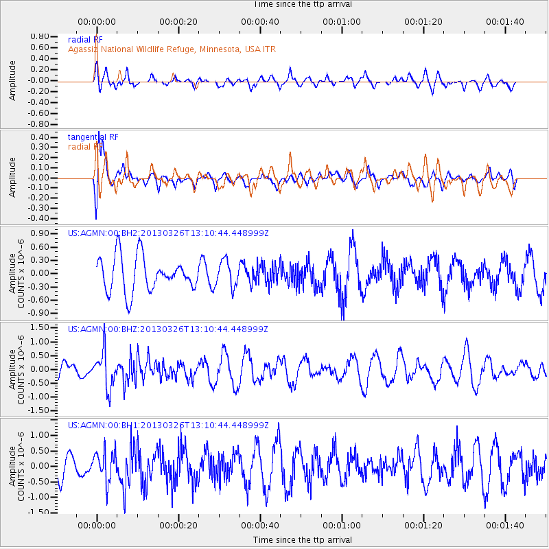
AGMN Agassiz National Wildlife Refuge, Minnesota, USA - Earthquake Result Viewer
*The percent match for this event was below the threshold and hence no stack was calculated.
| Earthquake location: |
Near Coast Of Guerrero, Mexico |
| Earthquake latitude/longitude: |
16.2/-98.2 |
| Earthquake time(UTC): |
2013/03/26 (085) 13:04:48 GMT |
| Earthquake Depth: |
10 km |
| Earthquake Magnitude: |
5.5 MB, 5.0 MS, 5.5 MW, 5.4 MW |
| Earthquake Catalog/Contributor: |
WHDF/NEIC |
|
| Network: |
US United States National Seismic Network |
| Station: |
AGMN Agassiz National Wildlife Refuge, Minnesota, USA |
| Lat/Lon: |
48.30 N/95.86 W |
| Elevation: |
351 m |
|
| Distance: |
32.1 deg |
| Az: |
2.88 deg |
| Baz: |
184.146 deg |
| Ray Param: |
$rayparam |
*The percent match for this event was below the threshold and hence was not used in the summary stack. |
|
| Radial Match: |
59.185436 % |
| Radial Bump: |
400 |
| Transverse Match: |
75.16302 % |
| Transverse Bump: |
400 |
| SOD ConfigId: |
558545 |
| Insert Time: |
2013-09-18 09:55:37.084 +0000 |
| GWidth: |
2.5 |
| Max Bumps: |
400 |
| Tol: |
0.001 |
|
Signal To Noise
| Channel | StoN | STA | LTA |
| US:AGMN:00:BHZ:20130326T13:10:44.448999Z | 1.5946907 | 6.7222334E-7 | 4.2153837E-7 |
| US:AGMN:00:BH1:20130326T13:10:44.448999Z | 1.7901171 | 4.873475E-7 | 2.7224334E-7 |
| US:AGMN:00:BH2:20130326T13:10:44.448999Z | 0.7525182 | 2.9525103E-7 | 3.923507E-7 |
| Arrivals |
| Ps | |
| PpPs | |
| PsPs/PpSs | |


