You are here: Home > Network List > US - United States National Seismic Network Stations List
> Station EGMT Eagleton, Montana, USA > Earthquake Result Viewer
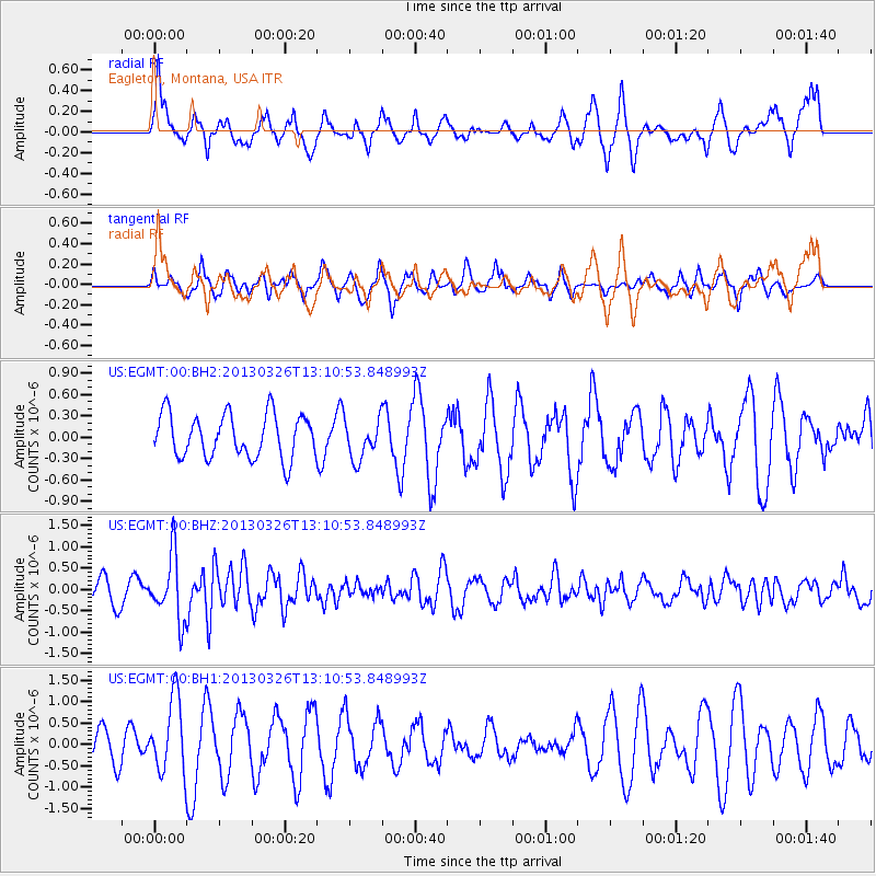
EGMT Eagleton, Montana, USA - Earthquake Result Viewer
*The percent match for this event was below the threshold and hence no stack was calculated.
| Earthquake location: |
Near Coast Of Guerrero, Mexico |
| Earthquake latitude/longitude: |
16.2/-98.2 |
| Earthquake time(UTC): |
2013/03/26 (085) 13:04:48 GMT |
| Earthquake Depth: |
10 km |
| Earthquake Magnitude: |
5.5 MB, 5.0 MS, 5.5 MW, 5.4 MW |
| Earthquake Catalog/Contributor: |
WHDF/NEIC |
|
| Network: |
US United States National Seismic Network |
| Station: |
EGMT Eagleton, Montana, USA |
| Lat/Lon: |
48.02 N/109.75 W |
| Elevation: |
1055 m |
|
| Distance: |
33.2 deg |
| Az: |
345.709 deg |
| Baz: |
159.309 deg |
| Ray Param: |
$rayparam |
*The percent match for this event was below the threshold and hence was not used in the summary stack. |
|
| Radial Match: |
55.910225 % |
| Radial Bump: |
359 |
| Transverse Match: |
53.072853 % |
| Transverse Bump: |
346 |
| SOD ConfigId: |
558545 |
| Insert Time: |
2013-09-18 09:55:49.638 +0000 |
| GWidth: |
2.5 |
| Max Bumps: |
400 |
| Tol: |
0.001 |
|
Signal To Noise
| Channel | StoN | STA | LTA |
| US:EGMT:00:BHZ:20130326T13:10:53.848993Z | 3.7312315 | 7.4889766E-7 | 2.0071059E-7 |
| US:EGMT:00:BH1:20130326T13:10:53.848993Z | 1.7235091 | 8.63188E-7 | 5.0083173E-7 |
| US:EGMT:00:BH2:20130326T13:10:53.848993Z | 0.91967314 | 2.8094885E-7 | 3.0548773E-7 |
| Arrivals |
| Ps | |
| PpPs | |
| PsPs/PpSs | |


