You are here: Home > Network List > US - United States National Seismic Network Stations List
> Station MSO Missoula, Montana, USA > Earthquake Result Viewer
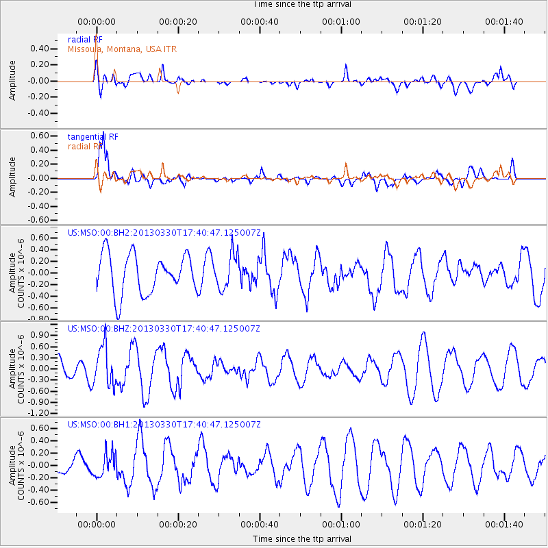
MSO Missoula, Montana, USA - Earthquake Result Viewer
*The percent match for this event was below the threshold and hence no stack was calculated.
| Earthquake location: |
Off Coast Of Northern Peru |
| Earthquake latitude/longitude: |
-9.5/-79.1 |
| Earthquake time(UTC): |
2013/03/30 (089) 17:30:47 GMT |
| Earthquake Depth: |
35 km |
| Earthquake Magnitude: |
5.8 MB, 5.4 MW, 5.3 MW |
| Earthquake Catalog/Contributor: |
WHDF/NEIC |
|
| Network: |
US United States National Seismic Network |
| Station: |
MSO Missoula, Montana, USA |
| Lat/Lon: |
46.83 N/113.94 W |
| Elevation: |
1264 m |
|
| Distance: |
64.1 deg |
| Az: |
334.12 deg |
| Baz: |
141.162 deg |
| Ray Param: |
$rayparam |
*The percent match for this event was below the threshold and hence was not used in the summary stack. |
|
| Radial Match: |
66.314896 % |
| Radial Bump: |
400 |
| Transverse Match: |
90.41378 % |
| Transverse Bump: |
400 |
| SOD ConfigId: |
558545 |
| Insert Time: |
2013-09-18 10:14:25.631 +0000 |
| GWidth: |
2.5 |
| Max Bumps: |
400 |
| Tol: |
0.001 |
|
Signal To Noise
| Channel | StoN | STA | LTA |
| US:MSO:00:BHZ:20130330T17:40:47.125007Z | 1.8640579 | 5.35862E-7 | 2.874707E-7 |
| US:MSO:00:BH1:20130330T17:40:47.125007Z | 1.1978619 | 1.9510469E-7 | 1.6287744E-7 |
| US:MSO:00:BH2:20130330T17:40:47.125007Z | 0.91815364 | 3.1166172E-7 | 3.3944394E-7 |
| Arrivals |
| Ps | |
| PpPs | |
| PsPs/PpSs | |


