FRB IQALUIT, N.W.T. - Earthquake Result Viewer
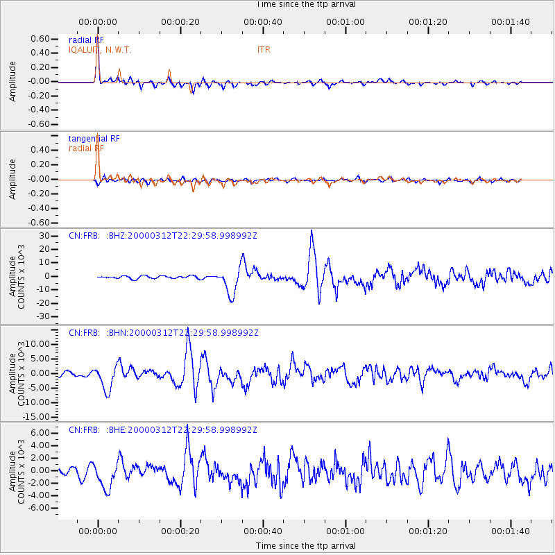
Earthquake location: Near Coast Of Chiapas, Mexico
Earthquake latitude/longitude: 15.0/-92.4
Earthquake time(UTC): 2000/03/12 (072) 22:21:30 GMT
Earthquake Depth: 62 km
Earthquake Magnitude: 5.5 MB, 5.8 MS, 6.3 MW, 5.4 MD
Earthquake Catalog/Contributor: WHDF/NEIC
Network: CN Canadian National Seismograph Network
Station: FRB IQALUIT, N.W.T.
Lat/Lon: 63.75 N/68.55 W
Elevation: 18 m
Distance: 51.5 deg
Az: 13.315 deg
Baz: 210.033 deg
Ray Param: 0.06722213
Estimated Moho Depth: 39.5 km
Estimated Crust Vp/Vs: 1.94
Assumed Crust Vp: 6.419 km/s
Estimated Crust Vs: 3.305 km/s
Estimated Crust Poisson's Ratio: 0.32
Radial Match: 94.48902 %
Radial Bump: 345
Transverse Match: 75.41477 %
Transverse Bump: 400
SOD ConfigId: 3744
Insert Time: 2010-02-27 05:43:18.029 +0000
GWidth: 2.5
Max Bumps: 400
Tol: 0.001

Signal To Noise

ChannelStoNSTALTA
CN:FRB: :BHN:20000312T22:29:58.998992Z7.3330644258.5996580.73944
CN:FRB: :BHE:20000312T22:29:58.998992Z3.3085572277.796688.456
CN:FRB: :BHZ:20000312T22:29:58.998992Z10.21843810168.898995.1519
Arrivals
Ps6.1 SECOND
PpPs17 SECOND
PsPs/PpSs23 SECOND