You are here: Home > Network List > UU - University of Utah Regional Network Stations List
> Station CCUT Cedar City, UT, USA > Earthquake Result Viewer
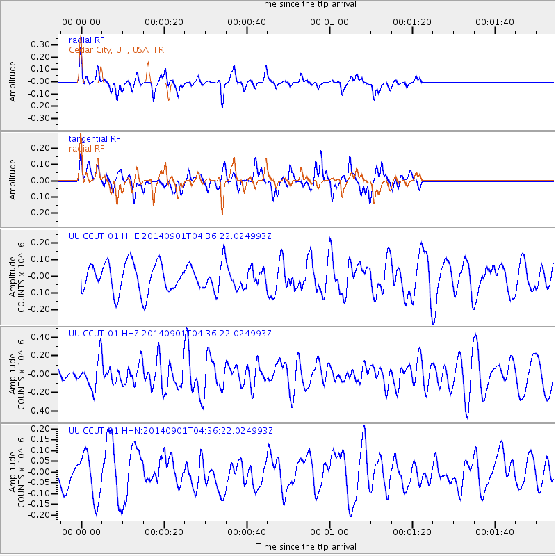
CCUT Cedar City, UT, USA - Earthquake Result Viewer
*The percent match for this event was below the threshold and hence no stack was calculated.
| Earthquake location: |
South Of Tonga Islands |
| Earthquake latitude/longitude: |
-24.9/-175.8 |
| Earthquake time(UTC): |
2014/09/01 (244) 04:24:16 GMT |
| Earthquake Depth: |
12 km |
| Earthquake Magnitude: |
5.3 MW |
| Earthquake Catalog/Contributor: |
ISC/ISC |
|
| Network: |
UU University of Utah Regional Network |
| Station: |
CCUT Cedar City, UT, USA |
| Lat/Lon: |
37.55 N/113.36 W |
| Elevation: |
2127 m |
|
| Distance: |
85.4 deg |
| Az: |
44.964 deg |
| Baz: |
233.816 deg |
| Ray Param: |
$rayparam |
*The percent match for this event was below the threshold and hence was not used in the summary stack. |
|
| Radial Match: |
48.37616 % |
| Radial Bump: |
256 |
| Transverse Match: |
57.430054 % |
| Transverse Bump: |
388 |
| SOD ConfigId: |
3390531 |
| Insert Time: |
2019-04-13 18:29:12.700 +0000 |
| GWidth: |
2.5 |
| Max Bumps: |
400 |
| Tol: |
0.001 |
|
Signal To Noise
| Channel | StoN | STA | LTA |
| UU:CCUT:01:HHZ:20140901T04:36:22.024993Z | 2.2777555 | 1.6144494E-7 | 7.087896E-8 |
| UU:CCUT:01:HHN:20140901T04:36:22.024993Z | 1.3927034 | 1.0536251E-7 | 7.5653226E-8 |
| UU:CCUT:01:HHE:20140901T04:36:22.024993Z | 1.0125377 | 8.825266E-8 | 8.715988E-8 |
| Arrivals |
| Ps | |
| PpPs | |
| PsPs/PpSs | |


