You are here: Home > Network List > UW - Pacific Northwest Regional Seismic Network Stations List
> Station HOOD Mt Hood Meadows, OR CREST BB SMO > Earthquake Result Viewer
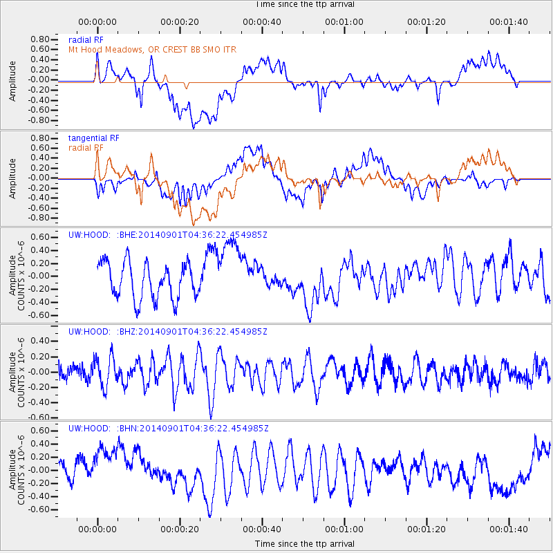
HOOD Mt Hood Meadows, OR CREST BB SMO - Earthquake Result Viewer
*The percent match for this event was below the threshold and hence no stack was calculated.
| Earthquake location: |
South Of Tonga Islands |
| Earthquake latitude/longitude: |
-24.9/-175.8 |
| Earthquake time(UTC): |
2014/09/01 (244) 04:24:16 GMT |
| Earthquake Depth: |
12 km |
| Earthquake Magnitude: |
5.3 MW |
| Earthquake Catalog/Contributor: |
ISC/ISC |
|
| Network: |
UW Pacific Northwest Regional Seismic Network |
| Station: |
HOOD Mt Hood Meadows, OR CREST BB SMO |
| Lat/Lon: |
45.32 N/121.65 W |
| Elevation: |
1520 m |
|
| Distance: |
85.5 deg |
| Az: |
34.988 deg |
| Baz: |
227.544 deg |
| Ray Param: |
$rayparam |
*The percent match for this event was below the threshold and hence was not used in the summary stack. |
|
| Radial Match: |
43.335033 % |
| Radial Bump: |
400 |
| Transverse Match: |
56.333233 % |
| Transverse Bump: |
400 |
| SOD ConfigId: |
3390531 |
| Insert Time: |
2019-04-13 18:29:21.473 +0000 |
| GWidth: |
2.5 |
| Max Bumps: |
400 |
| Tol: |
0.001 |
|
Signal To Noise
| Channel | StoN | STA | LTA |
| UW:HOOD: :BHZ:20140901T04:36:22.454985Z | 1.1629858 | 1.9882536E-7 | 1.7096113E-7 |
| UW:HOOD: :BHN:20140901T04:36:22.454985Z | 3.0037098 | 3.81389E-7 | 1.2697264E-7 |
| UW:HOOD: :BHE:20140901T04:36:22.454985Z | 1.8630159 | 5.12479E-7 | 2.750803E-7 |
| Arrivals |
| Ps | |
| PpPs | |
| PsPs/PpSs | |


