You are here: Home > Network List > UW - Pacific Northwest Regional Seismic Network Stations List
> Station UMAT Pilot Rock, OR, USA > Earthquake Result Viewer
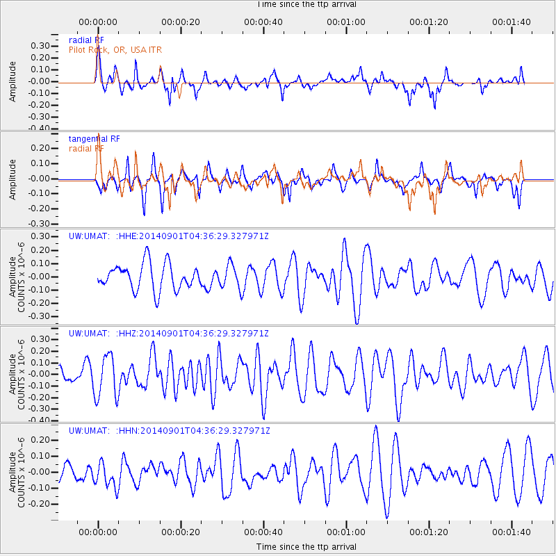
UMAT Pilot Rock, OR, USA - Earthquake Result Viewer
*The percent match for this event was below the threshold and hence no stack was calculated.
| Earthquake location: |
South Of Tonga Islands |
| Earthquake latitude/longitude: |
-24.9/-175.8 |
| Earthquake time(UTC): |
2014/09/01 (244) 04:24:16 GMT |
| Earthquake Depth: |
12 km |
| Earthquake Magnitude: |
5.3 MW |
| Earthquake Catalog/Contributor: |
ISC/ISC |
|
| Network: |
UW Pacific Northwest Regional Seismic Network |
| Station: |
UMAT Pilot Rock, OR, USA |
| Lat/Lon: |
45.29 N/118.96 W |
| Elevation: |
1318 m |
|
| Distance: |
86.9 deg |
| Az: |
36.272 deg |
| Baz: |
229.537 deg |
| Ray Param: |
$rayparam |
*The percent match for this event was below the threshold and hence was not used in the summary stack. |
|
| Radial Match: |
49.186535 % |
| Radial Bump: |
362 |
| Transverse Match: |
41.822136 % |
| Transverse Bump: |
273 |
| SOD ConfigId: |
3390531 |
| Insert Time: |
2019-04-13 18:29:25.277 +0000 |
| GWidth: |
2.5 |
| Max Bumps: |
400 |
| Tol: |
0.001 |
|
Signal To Noise
| Channel | StoN | STA | LTA |
| UW:UMAT: :HHZ:20140901T04:36:29.327971Z | 2.3233845 | 1.8695462E-7 | 8.04665E-8 |
| UW:UMAT: :HHN:20140901T04:36:29.327971Z | 0.84254825 | 8.091323E-8 | 9.603394E-8 |
| UW:UMAT: :HHE:20140901T04:36:29.327971Z | 0.9229644 | 8.9862866E-8 | 9.7363305E-8 |
| Arrivals |
| Ps | |
| PpPs | |
| PsPs/PpSs | |


